
Everything Matters
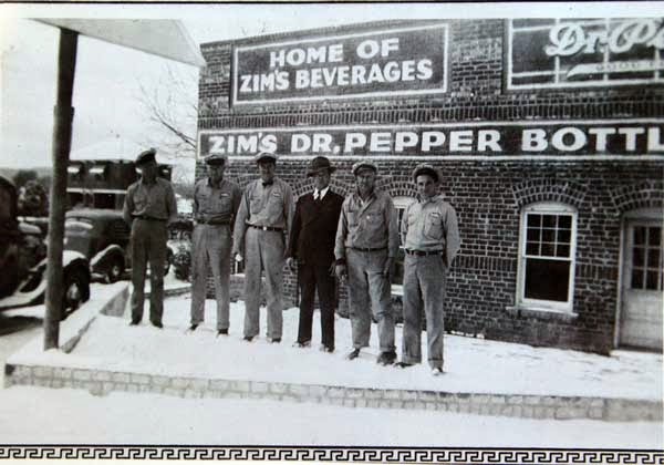
Zim's Bottling of Strawn
Showing posts with label Alameda. Show all posts
Showing posts with label Alameda. Show all posts
Tuesday, December 30, 2014

Tuesday, February 4, 2014
Gladys Seay
{Below please find the Tabernacle
chapter about Gladys Seay, about the day we met maybe four years ago, about the
day we talked together in Ranger. She was kind to me, patient. Her family lived
for a time down the sandy road from my Weekes family, mostly people I’ve never
met in real life. Gladys answered all of my questions. Helped me try to
understand a time I’d never visited, never imagined. Gladys passed away earlier
today. I pulled this out to re-read, and heard her voice again. Her memories
made me smile, and my heart break. I share her words from that day again in the
hopes that you will hear her voice as well.
JDC}
History. It's a word that
conjures up memories...of tests in high school we're not prepared for, of
boring afternoons at some relative's house when we're kids. We get
older. Make a little history of our own. Then wonder, how did we get
here? What came before?
Tuesday was a day that cannot be
successfully explained to a child. I've tried. Mine roll their eyes politely,
as I did when I was their age. I'm writing it down
though. Photographing it. Tasking myself – did I ask all the
questions that kids'll want answers for someday?

I visited with Gladys Seay and her
daughter Viola Boyer that Tuesday morning in Ranger. Gladys is Cheaney’s
oldest living former resident at 99-years-young, born April 15, 19 09. A
sharper mind and a clearer memory I have not yet encountered.
Gladys remembers Cheaney as a
close-knit farming community, of hard times, sad times, and mostly of
joy. It was a strange feeling, talking to a woman who actually knew the
people whose stories I've been searching for – relatives, friends of hers in
the community. She knew Cheaney’s historical protagonists first hand, went to
church with them, sat next to them in school – they were crystal clear in her
mind's eye. Because of her, I too could see them. The day was a
blessing.
Gladys is the daughter of John
Anderson Seay. Anderson Cook Canyon Anderson Oklahoma February 7, 19 18
Ironically, Gladys’ mother Pearl Jane
Heaton also lost her own mom (Amanda Jane Trosper Heaton) at the age of five in
1892. Mrs. Heaton did not survive a mastectomy, performed on the kitchen table.
Gladys’ father Anderson lost his own mother when he was three. Two generations
of motherless daughters left behind, one raised by a motherless father.
Gladys’ dad Anderson moved the family
to Texas Anderson Alameda
While Gladys was still young, Anderson
Gladys described the Cheaney
Community throwing huge picnics and “having Christmas” down in the Cook Canyon Kokomo
Gladys remembers as a young girl
being sent on horseback to the Strickler Store in Cheaney to get supplies for
her dad. Her dad was an industrious worker and didn’t have time to leave the
farm himself very often. Gladys remembered the store’s porch being high enough
that she could slide off the horse as a small girl and onto the porch without
having to dismount. The Stricklers would tie the groceries, supplies or tobacco
in a feed sack over the back of the saddleless horse, then the little girl
would slide back on the mare and ride home. When the family’s plow needed to be
carried to Strickler’s blacksmith shop to be sharpened, Gladys did that as
well. One of Anderson
Gladys named some of the teachers at
the Cheaney School-Mrs. Mary Wheeler, Chris Tucker and Miss Scott. Gladys
listed some of the families who had places near the Seays-the Howards, Snells,
Griffiths, Bartons, Weekes, and Blackwells. She remembers her daddy driving a
horse-drawn scoop to dig out a tank on the Allen Place Cook Cemetery
Gladys was the oldest of five
children, though only she and her brother Doc lived to adulthood. John Wesley
“Doc” Seay was named Doc by his uncle Tommy Seay. When Doc was a boy, he hurt
his ankle falling out of a wagon that was going too fast. Uncle Tommy had a
horse named Doc that was similarly afflicted, so he called the boy “Doc” as
well. The name stuck.
Doc ended up making a name for
himself as a preacher. He surrendered to preach at the Sweet Home Baptist Church Alameda
School Cheaney School Church
of Christ
Gladys married Sam Seay, whose family
lived to the west of Cheaney, December 21, 19 25SEE ). Sam was born in
1901, the sixth child of John William and Francis Farr Seay. His parents
married in 1889 at the Alameda
Church
One time Sam and Gladys traveled to Weinert , Texas Kokomo
Sam went to work for Humble Oil Co
during the oil boom in Cisco. He also worked in the oil fields of Ranger,
Eastland and Cisco. Sam and his brother Albert helped build the Cisco dam in
1920. Sam and Gladys had five children, all born at home.
Before Sam married Gladys, his family
lived in the old Duffer split log cabin for a time near the Leon River
The Sam Seays went to work for Dr. A.
K. “Doc” Wier in June 1934 and lived for a time in a house on his ranch. Doc
Wier bought the land from Doc Duffer. Gladys remembers there not being fences
built along the Leon
River
Their first house on the Wier Ranch
was originally a building used to store hay. When the Seays prepared to move
in, the building had no windows, doors, electricity, running water, or inside
toilet. The building was later clad with native stone. Oil lamps were used for
light. Meals were cooked on a wood cook stove. Gladys never learned to drive a
car, though she can milk a cow, pluck a chicken, raise a fine garden and of
course, run a household (as a child, and as a woman).
Gladys and Sam’s kids received one
new pair of shoes and one new outfit each year. Other than remembering the loss
of her mom, a smile never left Gladys’ face the day we visited. I forgot to ask
what her dreams were, as a girl growing up. I suspect her journey was not what
she expected, though I hope she ended up with the life she hoped for. “We can
not know what the Lord has in store for us,” she said. I have to believe He is pleased in her
result.
Friday, January 24, 2014
Frank Sanchez and Calvin Vernor
Frank Sanches Comes Home
Then Leaves Again
When I finally reached
the Nueces River Valley Leon Nueces ,
carving shallow bends and then deep water holes strikes me as sister to the
sometimes ferocious lion river snaking beneath Alameda Cemetery
Frank’s trail had gone cold, many months
before, far to the north in that Eastland
County
Frank left behind a wife and five children.
My found friend’s humble earthen grave has
been desecrated, on purpose – malice and aforethought. Like the Wicked Witch of
the West, a sturdy house has landed atop my hero’s final resting place. He’s
underneath that structure’s weight. Frank’s painstakingly-carved brown rock tombstone’s
been stolen, used to prop open a door like some trash rock from the field, then
taken into Travis
County
This Cheaney Community pioneer’s grave is unmarked.
If you don’t count the house.
Another man along my trail south told me,
not even a week ago: “There are only two types of people in this world, those
who build and those who destroy. It has always been like that. It will always
BE like that.”
That man was right.
I talk to my deceased friend today, to the
man buried beneath the house. Frank was and is the thick bottom trunk to a
sprawling family tree stretching across America
Graves never answer, in my experience.
I keep talking. “I need to know what
happened here.”
Stories from within those graves can speak,
however, if you listen long enough.
Frank Sanches somehow makes my seventy-two
cent black writing pen begin to talk. What you’ll read below is a true story,
told by a circle of people who have mostly never met. All Texans of good will,
and all the folks with ties to the Leon
River Valley
If you stand under the late-1800’s wooden
Tabernacle at Alameda Cemetery long enough, I believe that any man or woman who’s
ever walked or galloped past, living or dead, will again ride up and start
talking. Start telling stories. Crazy talk, I know.
But it keeps happening.
I’m sitting at my desk
working, checking emails. I receive a note from a lady who claims to be a
long-lost descendent of Frank Sanches. He’s the man that folks in Eastland County
I come to know it is our Frank Sanches.
The one whose two lost
log cabins sat alone and unguarded on the east side of Jim Neal Creek
Only a few hearthstone
rocks remain today.
Frank’s tangled story
scattered like dust, thrown into a cold autumn wind, as the Tabernacle book
left my hand. I knew he’d been there. I knew he’d left. I could walk to where
the man’s log cabin once stood. Like so many calling to me from that distant
fog, I surmised why he’d taken his family and abandoned ship (angry Comanches,
lots and lots of angry Comanches sweeping down their inherited raiding trail
along the Old Alameda Road. Not far outside Frank’s oaken front door).
As the book went to press, what happened
next was a mystery.
This is what I wrote
about Frank in The Tabernacle:
“Frank Sanches and
Jim Neal are the first Anglo men known to have settled in Eastland County Jim Neal Creek Leon River
The Sanches and
Neal log cabins stood empty when the census taker rode by in 1860. After the
Indians left that country in the 1870s, the Cheaney Community would spring to
life just southeast of Frank Sanches’ first brave toehold.
Francisco
(“Frank”) Sanches was a Creole from New Orleans , born between 1802-1808 in Louisiana , probably of Canary
Islander/Spanish descent (he probably had coal black hair, a good thing in the Leon River
Valley Texas
in 1835, the year before the Alamo fell,
(entrance certificate No. 472), and lived in Nacogdoches County
By the late
1840’s, Frank Sanches was living in Navarro County Walker
County Leon River Valley Hill County Parker
County Brazos , now known
as Sanchez Creek. From this base, he ran cattle in
Parker, Palo Pinto and Erath
Counties
As the frontier pushed westward, Sanches saw an opportunity to relocate his cattle operation
farther west into less crowded territory. He chose a site in the Leon River
Valley Eastland County Jim Neal
Creek
Sanches scouted a cattle trail that
came to be known as the Sanches Cattle Trail across Erath County Rattlesnake Mountain Eastland County Jameson Peak Mansker Lake Eastland County Abilene ,
Texas
The Stephenville - Fort Griffin Road Fort Griffin West Texas military posts. This
trail is
believed to follow one of the
original Indian Trails (based upon archeological findings along its path), and
eventually became the Old Alameda
Road
The Sanches cattle grazed far up and down the Colony Creek
Valley Leon River
Valley
By 1860, Frank Sanches and James Neal uprooted again to McLennan County Edwards County Nueces River
Frank
Sanches’ story while he lived in Eastland
County Palo Pinto
County Eastland
County Bosque
County
The Indians
killed the father and took the little boy captive. They left the settlements
with a lot of stolen horses and cattle. When the Indians were fifty miles
away, they took the boy’s clothes
and turned him loose in the wilderness, thinking he’d die of exposure/frostbite
or be eaten by wolves. The account says that little Ike found some cows,
staying with them for heat and sustenance until he was discovered.
Mrs.
Langston, in her History of Eastland
County tells us:
Frank
Sanches was out hunting stock and stood and watched numerous droves passing
down to the Leon River
Other
sources list parties other than Sanches as responsible for finding and
repatriating Ike Johnson.
Sanches
and Neal left Eastland
County
Whether
Sanches was still living along Jim Neal Creek in 1859 to meet Henry Mansker
(settling to his south at Mansker Lake) or John Flanagan (to his north near
present day Merriman in 1858), we will never know. If he did, his advice would
have been interesting to hear. Frank Sanches and Jim Neal voted with their
feet, and left this country, never to return.”
This is what Frank Sanches wanted us to know, after that
book’s journey was finally closed. Frank was long gone when Uncle Henry Mansker
and Mr. John Flanagan made it to our Leon
River Valley
The nice woman from the email puts me in touch with her
daddy, Calvin Vernor of Camp Wood ,
Texas
Calvin
Vernor is 79-years-old, and works hard every day. In addition
to his normal projects, he’s on the “restore the old Spanish mission committee”.
He knows the history of the Nueces
River Canyon
Frank was the
first Anglo settler living in the Upper Nueces
country. The man had a knack for being first to a place, seems like. He arrived
before the army got there to protect local settlers. He ended up living there
about ten years before being murdered in cold blood. Their first homestead was
above the Sanches Springs, in what is now Barksdale. Again, pulling out a map,
you’ll be struck by the echo of his place, just above a major river/creek
intersection, like say Jim Neal Creek two miles before hitting the Leon River.
The army got there
in 1857 (this is a well-documented date), so Frank probably arrived in the Nueces country about 1856. The army reports his being
there when they rode up. There were several beautiful springs there then, that
he carved his initials into. There was a cave at Wallace Mountain
Another man
explored out that way around 1921 and chiseled Frank’s work out of the wall to
bring back to town. When he got the old carving free of the wall, it was too
heavy to carry. He went back a couple of weeks later, he said, and Frank’s
artistic mark on the earth was gone.
I think about all
the carvings into the moss-covered stone up on Button Top, a prominent rock
mountain pug nose above the Leon ,
where stray Alameda
kids skipped school. The place is littered with old initials, carved into the
stone. I remember something else and smile. One of Frank’s sons, living not a
mile to the north of Button Top was nicknamed “Button”.
There are no
photographs or drawings remaining of Frank or his wife Jerusha that Calvin
knows of. Frank was a good man, a hard working man, Calvin tells me. He used
his Bible often. There were no churches down there, back then.
If you look at
photographs of the Nueces
River Valley Leon River Mansker Lake
You
also find out in a hurry that their valley was also a favorite stomping ground
for Native Americans of many Nations – Lipan Apaches, Comanches, et al. Flint
points, shell beads, pottery and many other artifacts testify that Native
peoples used the Water-Game-Protected Valley trifecta of the Nueces Valley as
their Eden, just as our Leon River Valley Natives did around Mansker Lake and
tributaries leading past it.
Franciscan friars
built an unsuccessful Spanish Mission, San Lorenzo
de la Santa Cruz
in 1762 at Camp Wood
The Camp Wood San
Antonio – El
Paso Road from Indian attacks. Camp Wood
After the War of
Northern Aggression (Civil War) concluded, army soldiers and Texas Rangers
periodically used the camp, it was said.
Bill
Badger, writing for the American
Military University Camp Wood Camp Wood , Texas Nueces River Canyon
The army reports
that the Frank Sanches Family were the first permanent settlers in the Upper Nueces
Canyon
Calvin knows of no
visible remains of their first homestead.
Frank built his
family a cedar picket house (straight cedars, sharp arrow-like points in the
air, driven vertically into the ground). I wonder if his Cheaney home was a
picket house too, much like the oak picket Blair’s Fort, built a few years
later to his southeast in Desdemona. Calvin tells me that Sanches Springs in Barksdale , Texas
Frank originally moved
to Nacogdoches
from a village outside New Orleans .
His parents got off ship at New
Orleans after arriving from the Canary
Islands about 1790. Frank was born in a settlement near New Orleans about 1814.
On July 22, 18 35Republic
of Texas Texas ),
a Christian, and unmarried without a family.
Frank married Jerusha
Tidwell on Feb 13, 18 44Republic of Texas Nacogdoches .
The 1850 census
shows Frank and his wife Jerusha having two children together, and that they lived
next to Frank’s friend Andrew Rojas in Navarro County Hill
County Bynum .
A daughter they named Winnie was born there. Winnie later married W. R. Webb.
That’s how Calvin ties to Frank and Jerusha.
Frank then ran
cattle on the open range farther north and was taxed for a 160 acre place in
Parker County (southwest of Weatherford) on a creek named Sanchez (spelled with
a “z”). I pass a green TxDot sign taunting “Sanchez Creek Estates” every time I
go west down Weatherford’s Ranger
Highway toward Alameda , Cheaney and beauty.
Calvin tells me
that Frank’s bride Jerusha (pronounced Ja-roo-sa) was a doctor for the army. A
soldier’s diary from the camp backs him up. Calvin doesn’t know how she got her
medical training, but she was definitely considered a healing frontier doctor
for that country. Perhaps her Cherokee mother or her French father taught her
the medical skills she possessed. She is known to have used native plants in
her practice, giving credence to Native training by her Cherokee Nation mom.
The Army hired her officially as their doctor at the camp. Calvin told me that
she removed lots of arrowheads from local settlers during their time down there.
I copied this from
the “1491 Days in the Confederate Army”, by W.W. Heartsill:
”June 10th (1861): At 4 o’clk this morning F. M. Marshall was violently attacked with an Apoletic (sic) Fit, and in thirty minutes in spite of medical aid he expired. This last unexpected death of one of our number, in addition to the one we heard of yesterday and the victim to day is (unreadable)…messengers of the other’s death, has cast a gloom over our Camp such as was never witnessed before; so soon, in less than two months, two of our number are ushered into Eternity. At 6 o’clkMarshall is buried with Military honors,
beneath the wide spread boughs of a large live oak, not far distant from Camp.”
”June 10th (1861): At 4 o’clk this morning F. M. Marshall was violently attacked with an Apoletic (sic) Fit, and in thirty minutes in spite of medical aid he expired. This last unexpected death of one of our number, in addition to the one we heard of yesterday and the victim to day is (unreadable)…messengers of the other’s death, has cast a gloom over our Camp such as was never witnessed before; so soon, in less than two months, two of our number are ushered into Eternity. At 6 o’clk
Remember that oak
tree.
Calvin tells me, “When
the North and South got to fighting, the army left and suggested that the
Sanches’s leave too. But they didn’t. The Army left in 1861. Calvin is said to
have told his departing Army neighbors, ‘I’m staying, y’all come back soon’.
Calvin shares that
Frank and Jerusha got along great with the Lipan Apaches coming up the canyons
from Mexico ,
though the Indians stole horses and cattle from other area settlers. Perhaps
Jerusha provided medical help to the Lipan, he wonders. Perhaps the family’s
black hair kept them safe, I wonder, remembering blond-haired savagery closer
to home. The Lipan Apaches and the Comanche Nation were then sworn Plains
enemies.
The Comanches
frequently attacked Frank while he was out working his stock. He always managed
to get away into the trees where arrows are less effective, and escape to home
and safety. Frank lived six more years after the Army left before the law of
averages caught up with him.
Calvin speaks to
me through a static-filled cell phone, more quietly this time, that when Frank
didn’t come in from working cattle that night, Mrs. Sanches got some men and
went looking for him. They found him fallen over dead with several arrows in
him, just above where the town of Vance is now, twelve miles above Camp Wood.
That was September 1867.
“At the time Frank
was killed by the Indians, there was hardly anybody here at all except him, his
wife and five kids and maybe a few other settlers,” Vernor said.
I think about the
long now-secret trails Frank and Jerusha traveled during their love together,
sad that their longing to live together until old age reward never came to
pass.
They took Frank’s
body home, traveling in fear of another sweeping Comanche attack, I’m sure.
They rode down the lonely Upper
Nueces Valley Bullhead
Mountain Hog Pen Mountain , Turkey Meridian Mountain
Frank was buried
under that same sprawling oak tree in the Camp Wood Army Post Cemetery Austin , Texas
There came a time
much later when the area around the town of Camp Wood started developing: about half the
new folks were good people, about half were said to be outlaws.
Another echo.
Some guy wanted to
build his new house in 1927 on the Camp Wood Army Post Cemetery spot where
Frank and Army soldiers and I’m sure other pioneers are buried, so he did. That
construction desecrated between 12 and 25 graves, it is thought. The house is still
standing, lived in I am told by a Church
of Christ
Unlike the heroes
and heroines of Alameda ,
Cook, Gregg and so many other Leon
River Valley Camp
Wood Army
Post Cemetery
Frank left blank a
space for the specifics of his demise, to be inserted later. I have a photo of
the stone. It would take your breath away, as it is a moss-covered brother to
the brown rocks that litter Alameda ’s
lonely hillside. It shows that Masonic emblem, carved by Frank’s industrious
hand.
Frank’s
tombstone was used as a back door stop from 1927 to when the property was sold
in 1945, when it was moved to the front of the house until 2005, then ended up
in Austin as a souvenir.
The F. M. Marshall
I told you about was the first burial at that cemetery. The cemetery has been
there since 1861 (a twin to Alameda ,
as there could be unmarked Alameda
graves dating back as early as 1859, based upon our settlement timeline, or
Natives likely before that.)
The Camp Wood
Army Post
Cemetery
The house sitting
astride those fallen Texans was recently remodeled and added on to. This is
some long-ago heresy against our past.
In October 1867,
Frank’s widowed wife Jerusha filed to have his estate administered (I have a
copy). The Letters of Administration list 16 cattle brands as his (like the multiple
cattle brands of Schmick and Mansker stock at Alameda ).
Frank was
Jerusha’s third husband. Jerusha means wife. All three of her men had been
killed by Indians.
I ask Calvin about
Jim Neal, Frank’s step-son-in-law for whom one of our creeks is named. He
recognized the Neal surname. Thought Jim Neal was a prior son to Jerusha,
before she married Frank. The Neals grew up in that Upper Nueces
Canyon Arizona
today.
Frank left behind
a loving wife and family – three boys and two girls who were industrious like
their parents. Jerusha was still a medical doctor who walked for miles to
deliver a baby or treat the sick. She passed away in 1884 from “cancer of the
face”, at 75 years of age, buried with a marked tombstone in the Vance Cemetery
The State of Texas has erected a historical
marker to her at Barksdale.
The three Sanches sons
continued to ranch and did some irrigated farming (Frank never farmed). After a
time, the only remaining child in the canyon was the youngest daughter, Winnie,
who married W.R. Webb.
There are thought
to be more than 1,000 descendents of Frank Sanches walking in this world. The majority
are in West Texas and Arizona . “The children changed their name
from Sanches to Little before 1900,” Vernor said. “Other descendents are Webb,
Hicks, Handley, Vernor and some others.” Little means the same as Sanches in
Spanish, I was told, but it also seems to come from the Latin “santus”…holy.
I wish you could
see Mr. Vernor’s notes to me, scrawled on photocopies from newspapers and
books, on index cards, on stray pieces of paper – not pretty, but the message
was passed and received…a treasure chest about a great man named Frank Sanches,
who in my mind, is today at last closer to home.
His hand-carved tombstone
still needs to come home, however.
And the house atop
his hallowed remains needs to be carefully removed.
This afternoon it
will soar to near 100 degrees, at the lonely Alameda Cemetery Tabernacle. This
part of one man’s tale is over, for now. Frank Sanches rides away…
------------------------------------------------------------
This story was roughed out to get the facts
down, not for publication (at least until Frank’s final resting place plot line
has been completed, and until proper citation can be undertaken). Based upon
the Army records, it will now be possible to more accurately reconcile the
dates of Frank’s life, which are currently all over the map. Many thanks to
Trisha Mayes; Mr. Calvin Vernor; the Uvalde Leader News; “The Images”, a book
by Wanda Handley; the Real County historical website; www.campwood.com/history.htm;
the County of Nacgodoches, Texas; Bill Badger, writing for the American
Military University about Camp Wood (“Camp Wood, Texas – A Military History,
1857 – 1861”); “1491 Days in the Confederate Army,” by W.W. Heartsill; Allen Stovall,
“Headwaters of Neuces River”, a book; and the City of Camp Wood.
Wednesday, January 22, 2014
First Peoples
First Peoples
The
Tabernacle
When the whole Indian thing came up,
Ken counseled that I should keep an open mind. He knew I’d run across white
settler stories detailing long years of Indian – Anglo conflict. He also knew
more than one flavor of Indian had lived in the Leon River Valley
Ken has a twisted sense of humor,
once you get to know him. Most of Ken’s best stories I can’t include, knowing
mom will read this someday. During his decades as a pumper, stomping around the
pastures and creek beds of rural Eastland
County
discovered
artifacts. He was able to construct an important map detailing twenty-five
Native American camps within the county, based upon these discoveries. Ken
catalogued what he found through the years, creating a rich historical Native
American tapestry fueling this chapter.
To protect the integrity of those
sites, many of which are still relatively undisturbed, their locations are only
described in general terms. They all fall with the “Alameda – Cheaney Box” detailed on Map I,
however. Rather than recite a long list of amateur finds by Ken and others, I
include only those which document certain time periods and cultures.
Sparse archeological study in Eastland County
The dense Cross
Timbers barrier was quite striking for westbound Anglo explorers who had just
crossed a wide open Blackland Prairie, covered with chest-high
native grasses. Most of these
travelers recorded this radical change, giving us first hand accounts of what
this country looked like. Randolph Marcy traveled this country extensively
when, saying, “At six different points where I have passed through [the Cross
Timbers], I have found it characterized by the same peculiarities; the trees,
consisting principally of post-oak and black-jack, standing at such intervals
that wagons
can’t without difficulty pass
between them in any direction. The soil is thin, sandy, and poorly watered.”
George Wilkins
Kendall with the Texan Santa Fe Expedition of 1841, called the Cross Timbers
"almost impenetrable" and "full of deep and almost impassable
gullies. The ground was covered with a heavy undergrowth of briers and thorn-bushes,
impenetrable even by mules, and these, with the black jacks and post oaks which
thickly studded the broken surface, had to be cut away, their removal only
showing, in bolder relief, the rough and jagged surface of the soil which had
given them existence and nourishment.”
Josiah Gregg
(1844) ascribed the forest’s density to fires, natural or started intentionally
by Indians. “Most of the timber appears to be kept small by the continual
inroads of the 'burning prairies for, being killed almost annually, it is
constantly replaced by scions of undergrowth; so that it becomes more and more
dense every reproduction. In some places, however, the oaks are of considerable
size, and able to withstand the conflagrations. The underwood is so matted in
many places with grape-vines, green-briars, etc., as to form almost
impenetrable 'roughs'.”
If a band of
Native peoples were looking for a place in which to disappear, Eastland County Leon River Valley Leon
River Leon ,
getting closer to the mid-point of the Alameda
– Cheaney Box, the valley widens to a smooth, gentle swale. Cliffs resurface on
the western side of this valley (Reid Ridge), just above Alameda Cemetery Alameda Cemetery Mansker Lake Leon River
The Leon
River
Many think of Central Texas as a land with plentiful lakes, reservoirs
and stock tanks. The vast majority of these are man-made, and those pretty
recently (1950s on). Before the impulse to impound runoff water for future use
began, large bodies of water like Mansker
Lake
Bill McGough
refers to Mansker’s waters as “the lake” from a distance of ten miles away as
late as the late mid-1800s. These peaceful waters were known to ancient
people, and were returned to often.
Its shorelines may have even been fought over, with the fallen dead buried in
the east-facing cliffs nearby (this Native gravesite long since desecrated).
Native peoples
visited Mansker Lake Republic of Texas Texas until the
mid-1700s. There are no known eyewitness sightings of Native Americans in our
specific Eastland
County
The natural food
basket that Natives sought was found in this stretch of the Leon River Valley
Bison would have
been hard pressed to get into this rough-terrain valley in large numbers, though
McGough reports them seven miles to the west. Big Foot Wallace also reports
bison near present day Victor, ten miles to the southeast. Either site is well
within the known range of Indian hunting parties. Theoretically, the McGough
Springs
bison to the west of Alameda could
have been herded to the Reid Ridge cliff on the western side of Alameda, and
driven over its edge into the fast moving waters below (like Natives did at the
Bonfire Shelter in Val Verde County…a similar, seventy foot high cliff). The
writer was unable to access the Reid Ridge land, to explore this theory, though
the topography, archeology and the nearby presence of bison fit.
If
Mansker Lake Texas areas. We cannot know for sure “who
these Indians were”. We cannot give those peoples definite names, like we later
can the Comanches, at least not yet. Additional investigation could fill those
voids.
All
these “could have” theories would have remained conjecture. That’s where Ken Falls Alameda ’s
rescue. Ken and I built a ladder of civilizations
together, driven only by the nature of artifacts found. Those artifacts become
markers for amazing periods of civilization in what is now sparsely settled
farmland. Additional hard work by citizens of the City of DeLeon corroborated our story.
DeLeon is a bustling town of 2,424 people, located 16 miles
south of Alameda .
Amateur and professional archeologists made tremendous progress putting their
Indian puzzle together. The preponderance of DeLeon’s Indians are thought to be
Wichita ,
divided into the Waco
and the Tawakoni. Their culture was a mix of Caddo to the east,
and Great Plains Indians to the west. They farmed a little,
but made frequent hunting trips to the plains.
Indians
would have been on foot until the later arrival of the horse-borne Kiowa and
Comanche. The Leon
River Alameda
and DeLeon. The water would have drawn game, just as it drew human life.
If Natives
preceding the Comanches also used smoke signals, smaller hilltop smoke sites
along its course could have reached the major Jameson Peak and Ranger Hill
regional smoke sites easily (a hilltop above Jim Neal Creek, the Schmick Ridge
below Alameda and the Staff (“Round”) Mountain sites all fit subsidiary smoke
signaling location profiles. Physical evidence was found at two of these sites.
Linda
told me to look for Indian footprints along paths of least resistance, when we
first met. She said that many settler roads (even a few highways) follow
prehistoric paths created by Native peoples. Plotting Mr. Falls findings, then
cross-referencing his work with the earliest known detailed road maps of Eastland County
A north-south
roadway recorded on a 1917 U.S. Soil Conservation Map implies an ancient
roadway connecting several Indian campsites, dating from the Archaic Era, 8,000
years ago. That same route was widely used as a public road until late 1878 by
settlers and travelers, when a new county road was built to its east, on higher
ground. This Old Alameda Road
forms the spine of much of this region’s early history, though it is now
largely invisible.
Bill McGough
(1859) places the intersection of the two overland Comanche War Trails a mile
and a half east of Desdemona, beneath the most important Native regional
mountain landmark, Jameson
Peak Alameda – Cheaney Box lies completely within.
It is likely the Comanches were not the first to travel this well-defined
migration path, as earlier peoples were also always on the move. This
intersection is eight miles from Mansker
Lake
The writer will
only identify the more stirring marker artifacts found, mostly arrowheads,
spear points and mano/metates, that suggest the timelines of the peoples who
left them behind. This discussion is informed by the extensive archeological
study undertaken around DeLeon.
The Clovis Culture of Paleo-Indian
presence begins with two Clovis points, found
inside the Alameda
– Cheaney Box. Nearby Native fire pits have not been carbon dated. Alameda ’s Clovis Man
lived for around 800 years, beginning 13,000 years ago. These Clovis
points were found near the Rock Ledge Shelter Camp.
mammoth, though the mastodon is the
only ancient megafauna whose remains have been found in this valley (to this
writer’s knowledge).
These early
Paleo-Indians are not thought to have been shelter builders. They might have
lived in the open, in trees, or beneath rock outcroppings. These outcroppings
are an easy walk from the Rock Ledge Shelter Camp site. Earlier shelter
outcroppings could have been softened or eroded away through the years by the
seasonally-flooding Leon
River
The Folsom Culture (9,000 – 8,000 B.
C.) hunted now-extinct ancient
bison, much taller than the animals alive today. These later Paleo-Indians were
slightly more sophisticated in their tool making than the Clovis
peoples. Folsom tips were found in the same area as the Clovis
tips, suggesting the site’s ongoing desirability, or perhaps even a linking
thread between the two people. When I later talked to Comanche Nation
representatives, they told me that their people believe that all Native peoples
share an eternal core linkage. Though it sounded like mystical allegory to me,
a part of their cosmic belief system, the Comanches’ spiritual legacy might
also literally explain the evolution of Native peoples at one location through
time.
The
Plano Culture is represented by Plainview
points, found at the Upper Leon Fulcrum Camp. This culture’s population lived
from 10,000 - 8,000 years ago. The sheer number of these people is thought to
be greater, as many more artifacts have been found. Metates show up as early as
this culture, but were used constantly until early
Historic
times. The Fulcrum Camp peoples widely roamed this
valley as flint scraping tools, several manos and metates and stone cleavers
have all been found as far south as the Alameda Cemetery Hamilton Place near Jim Neal Creek
A large year-round inland lake like Mansker Lake Great Plains .
The Antithermal may have made West Texas
uninhabitable, scientists believe. If the Antithermal caused bison to
disappear, Indians would be forced to retool, to hunt smaller game along wooded
river bottoms, like rabbit, turtle and deer. This Leon River Valley
The
Archaic Stage began about 6000 B.C. – 200 B. C. A Bulverde
Point from the Early Archaic Period (3,000 – 2500 B. C.) was found at the Alameda Cemetery
The
Native’s weapons transitioned to airborne delivery (arrows are shot, not
jabbed). Black-scarred middens begin to appear. There is no evidence of farming
at this stage, or constructed shelters, but again, cliffs and caves are
convenient to both sites.
The Middle Archaic Period (8,000 –
1,000 B. C.) announced cooler temperatures and more rainfall. Bison returned to
the recovering grasslands to the west. Pedernales points were found just north of Alameda
Cemetery
The Late Archaic Period brought a marked growth of population and
intense interaction. These folks gathered berries, roots, nuts, pecan and the lemon
size bur-oak acorns. They hunted deer, small game, and bison. Refuse mounds
filled with discarded bones, shells, and broken hearth stones formed the “rock
middens” of Central Texas , found in two places
within the Alameda
– Cheaney Box. The dart was their primary weapon. They developed a wooden
device called an atlatl to increase the power of their throwing arm.
Pottery
began to be made during this time, as well as organized agriculture. The bow
and arrow replaced the atlatl. The arrow points were much thinner, smaller and
lighter. Though Ruth Terry Denney mentions pottery in her well-written 1941 A Short History of Ranger, the writer did not interview anyone who found
Native pottery within the Alameda
– Cheaney Box. Anecdotal stories reported pottery finds on the upper Jim Neal
Creek Alameda Cemetery
The
Late Prehistoric Period (A. D. 600 – A. D. 1600) fully embraced
the bow and arrow, and pottery. Caddo and Plains Indian cultural influences
meld in this period, just prior to the first Spanish and French ventures into
this part of Texas .
Perdiz points found at Fulcrum Camp could point to a wide time frame, from the
1800 Historic Period as far back as the Late Prehistoric Period. Alba Points found at Fulcrum seem to better anchor the Late
Prehistoric I Period (1250-750 BP).
HISTORIC PERIOD (AD 1600 – Present). The Wacos seem to be in abundance in DeLeon, driven out
later by Lipan Apaches. The points found in the Alameda – Cheaney Box support DeLeon’s
discovery of a sizable Waco
civilization. Any Wacos left behind were surely eliminated by the Comanches,
beginning around 1740.
Indian campsites around DeLeon seem to be of two types –
the first contained flint arrow points. The second contained large spearheads,
hand axes, points with corner tangs, and grinding manos or “squaw rocks”.
Where the Leon and Sabanna merge south of DeLeon (eighteen
miles south of Alameda )
a large “war camp” was found. “It was in blow sand that was originally about
two and one half feet deep but has since exposed eleven small fire place mounds
about two feet in height and three feet in diameter at its base.”
“The major site of the second type was located east of De Leon on the
west bank of the Leon .
It covered an acre of ground and was a small hill so littered with mussel
shells as to resemble one of the shell heaps common on the coast. This site
produced a great many drills, mortars and manos, arrowpoints, large
spearpoints, hand axes and flint scrapers.”
Two professional digs near DeLeon found “Central Texas
Aspect” Clifton ,
Scallorn, Granbury and Perdiz points. A second division of the Neo-American
Stage called the Henrietta Focus found Harrell, Fresno and Young Points. The Edwards Plateau Alameda ’s,
a short distance to its north.
Ruth
Terry Denny believes that various flavors of Caddo were pushed into this area
from East Texas during this period by early
Anglo settlers. Earthen berms visually consistent with Caddo mounds were
observed at two sites in the Leon
River Valley
Denny
tells us “the Indians inhabiting the central part of
the State when (the) white man was moving West were, for the most part, these
speaking dialects of the Caddo language. They were the Caddos, Wacos, Wichitas , Keechies,
Andarkos, Tejas, Ionies, Adaes, Bedias, Ayish, Towash, Tawakanas, and the
Nachodoches. These tribes were builders of permanent homes, and cultivated
corn, melons, and vegetables for their
own use. Those inhabiting the North Central part of Texas were the Caddos,
Wacos, Keechies, Witchitas, and Towash tribes”.
Denny offers fascinating clues. “The meal bowls, pestles,
stone-hoos, and most of the flint artifacts found in Eastland County
When French, Spanish and Anglo explorers hit this land,
Native fortunes declined rapidly, on several fronts. Though scattered battles
killed both Indians and European explorers, the disease the fair-complected men
brought with them turned out to be their most effective weapon.
The introduction of the horse by the Spaniards near Taos and the rifle by the
French and Spanish helped the Apache and Comanche grow to dominate the region’s
more peaceful Caddo. Comanche hegemony continued to grow to the south,
eventually beyond the Rio Grande
into Mexico .
The Comanches probably beat Anglo covered wagons to the Leon River
Valley Eastland
County Mansker
Lake
First hand, written reports from this fated meeting
punctuate the beginning of Alameda ’s
recorded history. Though written in heroic language, and clearly from the Anglo
writers’ sole perspectives, they offer a look at this valley that is hard to
imagine today.
Pre-Comanche First Peoples arrived at Mansker Lake Leon River Valley
The parade of the Natives described in this chapter got the
wakeup call of their lives when “who came next” arrived. One morning many moons
ago, these mostly peaceful people heard the sound of mustang hoof beats in the
distance. Perhaps blood-curdling war cries filled the stilled air. Within the
space of a few years, the Comanche had displaced all who came before. And the
Comanche dug in, preparing for what came next.
Subscribe to:
Posts (Atom)