
Everything Matters
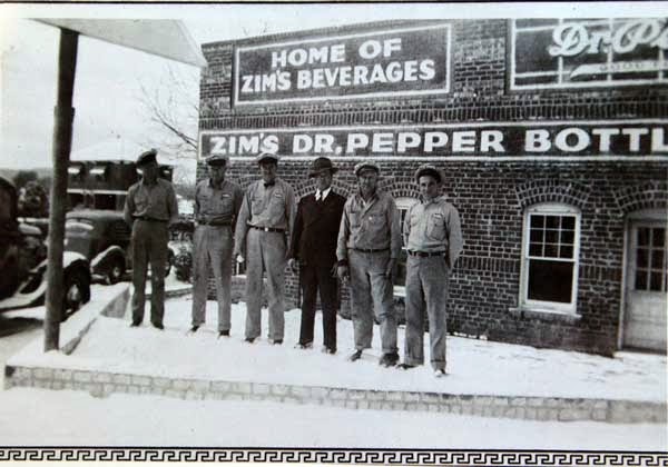
Zim's Bottling of Strawn
Showing posts with label Stephens County. Show all posts
Showing posts with label Stephens County. Show all posts
Monday, January 26, 2015

Monday, January 12, 2015


Tuesday, January 6, 2015


Friday, January 2, 2015


Thursday, May 15, 2014
It’s Important to Ask Questions
By Jeff Clark
It’s important to ask questions.
Up front.
To know your next partner before you head down a troubled
road.
I should’ve asked Barry about his affection for gravity.
About whether he felt fear.
Too late now.

I’ve been trying to get permission for some time to follow
the railroad right-of-way northeast from Ranger down the steep grade to Strawn.
They’re replacing the old cross ties through this part of the world with
concrete cross ties. The first rail worker we saw gave us the go ahead, just
stay away from the tracks.

This is rough Wiles
Canyon
It’s been hanging on tight to these hillsides with
white-knuckled fingertips ever since. If you want to see the original wooden
trestle, it’s on the top of page 14 in Alfred Rogers’ wonderful “Images of America –
Ranger” book.

Still, the T & P Railroad story is old news. We’re here
to search for U.S. 1, the dirt “highway” that climbed this canyon disguised as
an old wagon road. This U.
S. 1 route was abandoned before 1921,
perhaps earlier than 1919. This was before the Bankhead Highway that several in our
network remember.
Two crossings under the railroad are the only “for sure”
landmarks we can locate, to make sure we unwind this forgotten story from an
unshakable We’re Sure It’s True core.
I met Barry Franklin on the Ranger end of this gauntlet. I
should’ve grasped my predicament when my new friend rolls up with a death-defying,
high-powered Jeep, custom designed to thwart the most basic laws of physics
(gravity, up belongs on top of down, impact…you get the picture).
The T & P Railroad built its high wooden trestle across
the Russell Creek Gorge, the one that carved deep Wiles Canyon

Read: People with a (logical) fear (concern) of (unspeakably)
high (cursed) places (nightmares) should (forget it) content themselves (turn
back) with Google Earth (get over it and move on).

Barry promised to drive slowly. He smiled when he said it.
My brain believed him.
We saw the remains of the Sinclair Oilfield Camp through a
high game fence to the south. We saw remnants of old electric lines with glass
insulators still intact. We saw shattered rail road ties and broken-to-pieces
poles that my imagination believes carried telegraph lines and perhaps the
nefarious Jay Gould himself.
It coulda happened.

No camera can do justice to the view down the canyon, the
snake-winding tracks lowering gracefully toward the Strawn side of its journey.
If there were a 500 foot tall flagpole at Mary’s Café, I coulda seen it from the
top. I took several photos looking down the canyon, but the immensity of this
Big Country horizon defied my Nikon buddy its victory. Think Grand
Canyon , smaller, greener, friendlier.
We motored down a path next to the right of way. We stopped
in an abandoned rock quarry. We approached the site of the trestle and stopped.
I wanted to check it out on foot. Barry politely turned off his anxious Big Jeep
Monster and allowed me to disembark. Allowed me to search along the ground for
courage.
This is me looking down. Straight down. No longer in the
Jeep.
I will blur the rest of the story. Let the photos speak for
themselves. I walked the most narrow stretch of our journey. If my friend
laughed, he did it outside my presence. We drove straight up a couple of times.
We felt gravity grab hold of Mr. Jeep and roll “up or down?” around in its
mischievous hand like an white ivory dice. We didn’t roll over. Almost doesn’t
count, Barry told me.
I met a tiger. I saw an Indian head. I got
clues I’m not ready to announce. I stared straight down several trillion feet
and remembered what immigrant workers must have seen when they cut this path
through what was then and what is now still very much a slash of wilderness.

I saw an old road bed. Or maybe nothing. That’s the beauty
of trips like this.
We’re coming back, heading toward Ranger. We’re almost back
to the pickup and flat ground. Barry says in a calm steady voice, “You know, I
never feel fear.”
I’m looking for my seatbelt release. For how far down til impact
if I jump.
He says, “Nothing weird, just I’m not wired like that.” Barry’s
done motocross and four-wheeling at their most competitive national levels. “Fear
just never hits me.”
He answered the question I failed to ask.
Answered it honestly. Wished more people were like him.
Obviously I made it back. Hopefully it’s clear how much I
appreciate this man taking me past the place I would’ve stopped to get the
story.
Much of the time I prefer to walk on these adventures alone.
It’s hard to hear what the land wants to say otherwise. Still, there are a few
people who get it.
It was nice to approach an unknown place with someone at my
side. Not a fear thing, as much as a perspective thing. Sometimes old roads,
aren’t.
The route of U.
S. 1 is known, at least in a broad sense. I
believe by summer, given the good graces of some shiny now-locked gates up and
down this chiseled terrain, that this man’s Jeep will drive that old path once again.
Tuesday, March 4, 2014
Hohhertz Story
Hohhertz Oil Field Camp
Invites Past into Present
By Jeff Clark
Folks who
say Texas history
never dies haven’t driven enough dusty back roads. One passes old foundations, stacked
rock walls and “out of place” fence rows knowing that Lives unfolded out there.
Lives that
were never written down.
Teams of
archeologists, historians and forensic investigators could descend on the place,
I suppose. Years and millions of dollars later they could piece together a glossy
paper guess about the people who lived out there.
But without
those people, it’d still be a guess.

I was told
about the Hohhertz Camp, a Texas & Pacific Coal & Oil Company camp located
on Hohhertz Road ,
straddling the southeastern border between Palo Pinto and Stephens Counties
I didn’t
see a lot.
Like others
from my instant-messaging generation, I don’t have the time or that team of
specialists to help uncover all the lost places I hear about.
All those
clues calling from behind barbed wire fence rows.
Hohhertz Camp was started by the T
& P Coal & Oil Company sometime before 1917. Billy Gordon and his dad W.K.
of Thurber fame were said to be hunting around Hohhertz when the McClesky oil
well blew in that year, setting off the short-lived Ranger Oil Boom. They
returned to their car, finding a note on their steering wheel announcing the
news. That’s the earliest date I could verify. Seeping oil bedeviled several
coal mines to the south and southeast of the Hohhertz area in the late 1800s,
considered a nuisance by mine owners until Spindletop taught them better.

Oil camps were temporary settlements
where men drilled then pumped crude oil from the ground. The T & P believed
in owning everything – the land, the store, families’ homes, the school, the
office, the recreation hall, probably some tents. Think Thurber, but smaller,
more mobile.
There might’ve been 250 living in
the community near its beginning. When the wells were all drilled, this number tapered
down over the years.
Towards the 1930s, Hohhertz Camp changed
from drilling, to mostly pumping and maintenance. Make sure the oil continues
to flow, but we’ll be in Midland
or Odessa if
you need us.
I went through lots of folks who
held small pieces of the puzzle until I happened upon the Sinclair girls –
Ellen, Norma and Billye. They grew up there. And then Stanley Bowen. His childhood memories were
shaped a few yards down the 1 x 12 wooden side walk from the Sinclair house.
I pulled up a chair. Took out a
pen.

Hohhertz Camp was a community in
every sense of the word. The first row of five or six identical company-owned houses
lining Hohhertz Road
faced south, just across the Stephens
County
There were three rows of these houses,
maybe 18 total. There were four or five more homes scattered south into Palo Pinto
County
The Sinclair girls’ daddy William
Bryan Sinclair probably worked in Hohhertz longer than anyone, he maintaining a
pump station down the hill through the trees adjacent to the Hohhertz Ranch
until he retired in 1965. Sinclair could fix or build most anything. Rattlesnakes
slithered the countryside then and now. Below that hill sat a huge gas engine
(called “The Power” by residents) that ran 15 – 23 rod lines powering pumping oil
rigs in the fields.
The Sinclair house started with two
bedrooms, but Mr. Sinclair added a third. They had a bathroom and shower,
living room and kitchen. Their yard had cut grass and rock-lined flower beds.
If you’ve never been out to that part of the world, it’s rough rocky country.
The Sinclairs had a garden.

The camp houses boasted natural gas
and indoor plumbing, but no electricity until the REA years later. The Wirt Goodsons
owned a Maytag washing machine, though they had to heat the water in big
boiling pots and “prime” the clothes with the rub board first.
Toward the 1940s and 1950s there
were about 20 oil wells on the 800+ acre Stuart Place , the southern area of Hohhertz.
Lone Star Gas had a camp out there somewhere too.
Early Hohhertz Camp was said to have
a one room school on the south side of the road (below the water tower) that
closed around 1930. The Sinclair girls remember bus rides to Caddo through 6th
grade, then junior and senior high school students being bussed to
Breckenridge.
Families paid rent. Twelve
unmarried pumpers lived in a bunkhouse where meals were served. A party line
phone connected these homes across the cattle guard, a T & P company sign welded
overhead. The elevated water tank looks like a brother to the one at Thurber’s Big Lake

Kids used to play kick the can, ante
over, took walks, rode bikes and played ball in the street. The most vivid
activity I heard about was their Color Stores. These stores’ “inventory”
consisted of bottles the kids filled with colored water, which they would then
“sell” to each other. Stanley 's brother Junior Bowen always came up
with odd colors that nobody else could figure out how to make.
Paper dolls
were a big item, cutting the dolls out of Sears Catalog, using candy boxes as houses,
making all sorts of "furniture" then pulling the candy
boxes along with a string (moving their houses from place to place).
The boys had rough hewn clubhouses
out in the countryside where they’d smoke grapevine and carry on as boys will.
All these kids remembered the Color
Stores.

Families traveled to Ranger to buy
groceries and watch wrestling and boxing matches. Dave Mitchell had a hoedown at
one of the houses – guitars and banjos making everyone hoop and holler with
delight.
The Sinclairs remember a little
store with a little bit of everything. Troyce Boone’s dad Daniel ran the
Hohhertz Store in its earliest days. I don’t know if he owned it or just
managed it for the company. Bowen remembered Mrs. Herrington running this store
in the 30s and 40s. Then the Roaches. Mrs. Herrington lived in a company house,
though she was not a company employee like everyone else.
The T & P Office was on the
south side of the road. Don Bonney was the big boss, the superintendent, a nice
man, the Sinclairs remembered. Everybody liked him.
T & P fashioned a recreation
building out of an empty house where women quilted and chatted, a quilting
frame hanging from the ceiling. The men played pool, dominoes and 42. A little
friendly wagering.
Rodney Mitchell spent 1946 in Hohhertz,
his first year of life. He remembers 30 people living there then, the water
tower on left, clapboard shacks scattered all about.
Dean and Lois Wilson were the last
to live in company housing there. They moved their house to Strawn where it
still sits. Hohhertz was a place where families were raised, where couples fell
in love, where life was lived then passed on to children.

Like many T
& P operations, most of the actors in this play moved on. There are a few
down the hill in Strawn’s Mount
Marion Cemetery
Hohhertz Camp the place is empty.
The community is scattered out there in the world, for a while longer, stretched
thin by decades of moving forward to whatever came next.
If you read this and you have
memories of old Hohhertz Camp, shoot me an email. Pull up a chair with the
others. We’re waiting to hear from you.
Sunday, January 26, 2014
Fairbanks
Sometimes you search through the woods, then turning the last of many corners, pushing through dense limbs of oak or cedar, you walk onto the stage setting of a life that happened long ago.

Like you're suddenly in a darkened theater, waiting for the curtain to go up on whatever Shakespearean tragedy you've stumbled into. The longer ago the curtain rose, the fewer clues await you upon this stage. Stacked rock walls, rising upward past the knee, covering maybe a quarter acre, maybe stacked rock corrals like old man Milsaps over toward Oak Crossing's of the Brazos.

Not naturally occurring. We're sure of that. Then long nails, more than a few rounded heads, rusted once-molten hammered fingers that held rotting timbers no longer visible here, perhaps carried off by prairie fires. Rusted nails, laying in the too fine loam, brown with regret.

There's a rise just behind, a vantage point it would seem, off toward the towering mountain where a man could put a cabin, but I see no signs. Walking back, more pictures, I find colored glass, "W I" on its head, part of a word or a company name like Mason from back east. Two letters you might puzzle over, before we lose our light.
There's a break in the old fence line, depressions, treads, a path wagon-wide that leads out to a road, forced there by the pincers of the canyon, leading north toward the pass, south to cross Palo Pinto Creek.
A man lived here, I was told, two wives, one at a time, dying, both, don't know why, buried up there on that mountain, side by side, up there in those woods.

Life was harder then, or at least more to the point. Stacked rock walls, light fading to the west behind the tall ridge, growing dark.
More walking is needed.
Like you're suddenly in a darkened theater, waiting for the curtain to go up on whatever Shakespearean tragedy you've stumbled into. The longer ago the curtain rose, the fewer clues await you upon this stage. Stacked rock walls, rising upward past the knee, covering maybe a quarter acre, maybe stacked rock corrals like old man Milsaps over toward Oak Crossing's of the Brazos.
Not naturally occurring. We're sure of that. Then long nails, more than a few rounded heads, rusted once-molten hammered fingers that held rotting timbers no longer visible here, perhaps carried off by prairie fires. Rusted nails, laying in the too fine loam, brown with regret.
There's a rise just behind, a vantage point it would seem, off toward the towering mountain where a man could put a cabin, but I see no signs. Walking back, more pictures, I find colored glass, "W I" on its head, part of a word or a company name like Mason from back east. Two letters you might puzzle over, before we lose our light.
There's a break in the old fence line, depressions, treads, a path wagon-wide that leads out to a road, forced there by the pincers of the canyon, leading north toward the pass, south to cross Palo Pinto Creek.
A man lived here, I was told, two wives, one at a time, dying, both, don't know why, buried up there on that mountain, side by side, up there in those woods.
Life was harder then, or at least more to the point. Stacked rock walls, light fading to the west behind the tall ridge, growing dark.
More walking is needed.
Thursday, January 9, 2014
Caddo, Texas
Caddo, Texas
I’ve been bouncing across a too-rough-for-little-cars gravel
road for over an hour, its rocks sharpened daggers, listening for the
inevitable flat tire. I’m deposited on the southern shore of Highway Stephens County
I have an hour to kill, my next appointment not til 3. I drive
around Caddo.
Lots was here.
Little today.
This 1870s Anglo settlement is said to be on the site of a
Caddo Indian camp. When the oil boom hit around 1916, the population swelled to
over 1,000. Some say more.
I spy an old wooden tabernacle being reclaimed by the woods.
Like always, I stop to hear what it has to say. Its shadows hide several
hundred yards away from the freshly-painted Caddo church. I’m not sure if the
church is open or closed. The tabernacle is closed. Is in its final moments.
The Caddo
Cemetery
Highway 80 bypasses where downtown Caddo used to be. Or
still is, I get confused. This road gets some traffic, but no one’s moving out
there to set up shop. No one gets it.
Traffic.
Second chances.
Even the proud Caddo Mercantile at the westbound Y junction
of Loop and Bypass is closed, is for sale,
after many bites at the apple.
Buildings here were once nailed together hastily in wood
plank. Tents were pitched. Tomorrow would take care of itself.
There are a few nice homes sprinkled still – less than ten.
Scattered mobile homes, well, doing what mobile homes tend to. These streets,
the few nature’s not reclaimed, host once proud structures that have fallen to
their knees, then given up their fight to the ground into which they rot.
Others should’ve been bulldozed, before this decay gained
momentum. I have to believe someone said something. Once.
Whatever happened or failed to happen, few are here to see
the result this day. Folks like me swing through, attracted to the poignant ghost
stories digital photos can unspool onto our computers.
The post office is open, its lone employee parked out front.
Most driveways are empty. Folks at work. Others never coming
home.
Cars whiz past as I pull back onto Highway 80. Traffic turns
to the state park to the north. To Ranger going south. There was a time this
traffic could’ve stoked some commerce, some jobs. But like the proud Caddo Native
people, oil moved on. People moved away. Those left behind failed to adjust.
Failed their future.
We are one quiet chapter from the end. It’s time to go.
Saturday, January 4, 2014
Buggy Horse Story
Buggy Horse Story
I Hope to Meet Him Soon
Snippets slide past my boat nearly every day. Too many to chase after.
So call this a breadcrumb. Maybe the answer will come following up this trail one day.
This happened before 1906, maybe in late 1800s. Up along Hohertz Road, between Strawn and Necessity. I’m pretty sure it’s true.
A lady wanted to catch her buggy horse so she could go to town. It was running with the neighbor’s horse, playing, carrying on as horses will. The lady was in a hurry. Or not used to waiting. She pulled out a shotgun, shot the neighbor’s horse dead.
She had places to be.
The lady hitched her now friendless horse to the buggy and went on her way. I’m sure her horse knew better than to do that again.
Later that day, the lady’s neighbor returned home and found his horse dead. He figured out what must’ve happened. This neighbor man marched out into the woods, found the impatient lady’s husband in the field dressing hogs. I like to think he was happy, out there alone, not bothering anybody.
Her husband was a man who wasn’t lucky.
The aggrieved neighbor shot her husband dead. The man didn’t know his wife had even done that. He didn’t know what she had done. Cost him his life, it did.
This dead husband man is buried out on that hillside still, I’m told, behind a cable fence, overgrown with weeds and mesquite.
At least it’s over.
I hope to meet him, soon.
Tuesday, December 17, 2013

Subscribe to:
Posts (Atom)