
Everything Matters
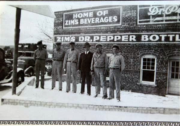
Zim's Bottling of Strawn
Showing posts with label Palo Pinto County. Show all posts
Showing posts with label Palo Pinto County. Show all posts
Monday, January 19, 2015

Saturday, January 17, 2015


Wednesday, January 7, 2015

Sunday, January 4, 2015


Saturday, December 27, 2014

Wednesday, December 24, 2014

Saturday, December 20, 2014

Tuesday, June 3, 2014
Thurber's Ghost
Thurber’s Ghost
By Leo S. Bielinski, Ph. D
Many
cities have some sort of a ghost story. Thurber was called a “Ghost Town” after
it was abandoned in the early 1930’s. But “Ghost Town” is a misnomer, for there
have always been several residents living in Thurber. Some of these residents added
to the legend of a ghost seen in this “Ghost Town.” While the later residents
speak of a lady ghost seen and heard in downtown Thurber, the Thurber Ghost
seems to have originated in the Thurber Cemetery back about 1920.
Frank
Tolbert of the Dallas Morning News resurrected the ghost story in a May 15, 1983
story. At that time, the owner of the restaurant in Thurber was irritated
because three of his employees had just quit because they claimed that Thurber
had ghosts “in residence…Two of the employees were a married pair of Cuban
refugees, and the other was a 65-year-old maintenance man.” These employees
lived in apartments above the restaurant. The restaurant was in the bottom
floor of the old two-storied Thurber Drug Store.
Tolbert
also related that he had first heard of the ghost story in 1955 from Mrs. Eliza
Whitehead, one of the “old-timers” who had seen and heard a singing ghost. “I
been here 40 years…I was just walkin’ in downtown one
night and here come this pretty woman singin’ in some
funny way. Then she just went away right in front of my eyes.”
Thurber
had an opera house and Thurber, with its large opera-loving Italian population,
was a regular stop for touring opera companies. And Albert Whitehead, Eliza’s
husband, corroborated Eliza’s story. “You don’t catch me passin’
through town after dark.” The Whiteheads remained in Thurber as caretakers of
the remaining houses and buildings, particularly the “Guest House” (W. K.
Gordon’s Home), where company “Big Shots” stayed when they came to Thurber for
hunting and fishing.
Walter
Kostiha and his brother Frank claimed to have seen
the ghost. This was about 1925 when Thurber was beginning to shut down. The Kostihas lived near the old jail house, which was just
north of downtown Thurber.
Walter:
“I don’t care whether you believe me or not. I know what I saw, even if I was
about five or six years old. I was with my brother Frank behind the old grocery
store just about dark. We saw this woman in a white gown and she was singing or
saying something out loud. We took off running.”
The
Fort Worth Star Telegram (Oct 26, 1997) in a weekend Halloween edition did not
help matters when they wrote “The Thurber Cemetery is one of the biggest Texas historical
cemeteries. It is also one of the scariest places to be on a dark night. The
trees bend over the graves as if in mourning for the 700 (sic) or more children
buried there. The epidemics of scarlet fever and whooping cough…definitely left
their mark on this Texas Ghost Town.”
Raymond
Bridier had a plausible explanation for the origin of the Thurber Ghost. When
Raymond was about ten years old (say, around 1920), on moonlit nights a bunch
of kids would meet at the ball park, which at this time was on top of Grave
Yard Hill next to the cemetery. They would smoke cedar bark, play games like
“kick the can” or just talk.
One
night as they were going home, they noticed a lady in a white gown sitting on
the top step of the sty (steps over the fence) in the southeast corner of the
cemetery. She was crying or praying loudly, perhaps for a loved one she had
recently buried in the cemetery. The kids thought this behavior odd but this quickened
their pace toward home.
The
following night the same scene, but this time they took off running; something
had spooked them. Now, they were afraid to play in the ball park after dark.
But several weeks later courage returned and they went back up the hill. Nobody there. They smoked, played their games, but as they
exited the ball park and headed for home, she was there! She stood up on the
steps and started toward them! They panicked and went tearing down the hill.
They never went back to the ball park, and shortly thereafter, the ball park
was moved to the east side of Thurber.
After the ball park episode, which seemed a plausible
happening, all the alleged sightings have been in downtown Thurber. Some have
said the singing is caused by the wind whistling through the old buildings. But
Eliza Whitehead or Walter Kostiha
would never believe that because they saw her with their own eyes and heard
her.
The Thurber Cemetery Thurber
Cemetery
Thursday, May 15, 2014
It’s Important to Ask Questions
By Jeff Clark
It’s important to ask questions.
Up front.
To know your next partner before you head down a troubled
road.
I should’ve asked Barry about his affection for gravity.
About whether he felt fear.
Too late now.

I’ve been trying to get permission for some time to follow
the railroad right-of-way northeast from Ranger down the steep grade to Strawn.
They’re replacing the old cross ties through this part of the world with
concrete cross ties. The first rail worker we saw gave us the go ahead, just
stay away from the tracks.

This is rough Wiles
Canyon
It’s been hanging on tight to these hillsides with
white-knuckled fingertips ever since. If you want to see the original wooden
trestle, it’s on the top of page 14 in Alfred Rogers’ wonderful “Images of America –
Ranger” book.

Still, the T & P Railroad story is old news. We’re here
to search for U.S. 1, the dirt “highway” that climbed this canyon disguised as
an old wagon road. This U.
S. 1 route was abandoned before 1921,
perhaps earlier than 1919. This was before the Bankhead Highway that several in our
network remember.
Two crossings under the railroad are the only “for sure”
landmarks we can locate, to make sure we unwind this forgotten story from an
unshakable We’re Sure It’s True core.
I met Barry Franklin on the Ranger end of this gauntlet. I
should’ve grasped my predicament when my new friend rolls up with a death-defying,
high-powered Jeep, custom designed to thwart the most basic laws of physics
(gravity, up belongs on top of down, impact…you get the picture).
The T & P Railroad built its high wooden trestle across
the Russell Creek Gorge, the one that carved deep Wiles Canyon

Read: People with a (logical) fear (concern) of (unspeakably)
high (cursed) places (nightmares) should (forget it) content themselves (turn
back) with Google Earth (get over it and move on).

Barry promised to drive slowly. He smiled when he said it.
My brain believed him.
We saw the remains of the Sinclair Oilfield Camp through a
high game fence to the south. We saw remnants of old electric lines with glass
insulators still intact. We saw shattered rail road ties and broken-to-pieces
poles that my imagination believes carried telegraph lines and perhaps the
nefarious Jay Gould himself.
It coulda happened.

No camera can do justice to the view down the canyon, the
snake-winding tracks lowering gracefully toward the Strawn side of its journey.
If there were a 500 foot tall flagpole at Mary’s Café, I coulda seen it from the
top. I took several photos looking down the canyon, but the immensity of this
Big Country horizon defied my Nikon buddy its victory. Think Grand
Canyon , smaller, greener, friendlier.
We motored down a path next to the right of way. We stopped
in an abandoned rock quarry. We approached the site of the trestle and stopped.
I wanted to check it out on foot. Barry politely turned off his anxious Big Jeep
Monster and allowed me to disembark. Allowed me to search along the ground for
courage.
This is me looking down. Straight down. No longer in the
Jeep.
I will blur the rest of the story. Let the photos speak for
themselves. I walked the most narrow stretch of our journey. If my friend
laughed, he did it outside my presence. We drove straight up a couple of times.
We felt gravity grab hold of Mr. Jeep and roll “up or down?” around in its
mischievous hand like an white ivory dice. We didn’t roll over. Almost doesn’t
count, Barry told me.
I met a tiger. I saw an Indian head. I got
clues I’m not ready to announce. I stared straight down several trillion feet
and remembered what immigrant workers must have seen when they cut this path
through what was then and what is now still very much a slash of wilderness.

I saw an old road bed. Or maybe nothing. That’s the beauty
of trips like this.
We’re coming back, heading toward Ranger. We’re almost back
to the pickup and flat ground. Barry says in a calm steady voice, “You know, I
never feel fear.”
I’m looking for my seatbelt release. For how far down til impact
if I jump.
He says, “Nothing weird, just I’m not wired like that.” Barry’s
done motocross and four-wheeling at their most competitive national levels. “Fear
just never hits me.”
He answered the question I failed to ask.
Answered it honestly. Wished more people were like him.
Obviously I made it back. Hopefully it’s clear how much I
appreciate this man taking me past the place I would’ve stopped to get the
story.
Much of the time I prefer to walk on these adventures alone.
It’s hard to hear what the land wants to say otherwise. Still, there are a few
people who get it.
It was nice to approach an unknown place with someone at my
side. Not a fear thing, as much as a perspective thing. Sometimes old roads,
aren’t.
The route of U.
S. 1 is known, at least in a broad sense. I
believe by summer, given the good graces of some shiny now-locked gates up and
down this chiseled terrain, that this man’s Jeep will drive that old path once again.
Friday, March 28, 2014
The Whisper of Old Owl
The Whisper of Old
Owl
Through
The Windshield
I
left Weatherford this morning, in search of Old Owl’s camp. It was last seen in
1849, best I can tell. If the stories are true, it lies just south of my
Alameda-centric box. A full moonlit night would carry a warrior’s steed to the
Mansker Lake Community in an hour.
I
turn south on Hwy 16 from I-20, the morning sun still coming in my east truck
window. I figure a trip across the foot of Cook Canyon
I’ve
tried to develop the skill of seeing
the land without its roads and fences. My John Wayne-colored glasses warn me
that Indians might lurk along the cedar-covered rim of the canyon to my right,
awaiting their chance to swoop down and surround me, fill me with piercing
arrows. This canyon still whispers its tragedies, from not so long ago.
I
pass across Palo Pinto Creek, the Indians’ highway through this country,
creating stories we’ve all heard, and a few never repeated, I’m sure. The
project’s
newest contributor, the one
translating darkly from outside our log cabin’s walls, says it’s important to
get a sense of a place. That the
Comanche were attuned to their world in a way that’s difficult for moderns to
understand. I sense as I cross this creek that I’m entering their world, hoping
for a sign I can follow into Old Owl Mopochocupee’s flourishing camp, one of
the largest Comanche camps in Texas .
What
do you ask of a Comanche who died over 150 years ago? Will he ride around with
me and point out all the old sites, my newest Shorty Fox? Will he have photos
of the significant people and places from his nomadic world? “This is me and my
friend Running Cloud the day before we attacked that wagon train up north –
good times.” Will he be able to tell me what he, and later Buffalo Hump felt
when these cursed settlers kept pouring over the hill from three directions,
killing all that the Comanche held dear?
To be clear, I
have little idea what I’m looking for. I feel pretty confident when I’m
tracking Anglo sites now, when looking for abandoned cemeteries, homesteads or
schools. Crooks in the road, cisterns in a field, fence lines that make no
sense – I can pursue these footprints with some assurance. With the Comanches,
I find myself again at the bottom of a new learning curve. Hopefully they will
share some guideposts I will need to track them, to make contact.
I
ascend up the southern rim of Cook
Canyon Salem
and Hogtown. This flatter plain would’ve been an easier path for our new
friends to follow, moving northwest toward Mansker Lake
started showing up, the Comanches
could have continued, on toward their camp near Sweetwater. Later, they could
have stalked silently back to their reservation undetected, late at night. Our
new friend counsels, “look for paths of least resistance.” Our old roads often
follow theirs.
I
near Hogtown. Nearby Blair’s Fort is the last stop on the Stephenville – Fort Griffin Road
that I’m sure of. Some writings suggest it headed to Dallas Scott’s place on
the hill east of Mansker
Lake
Desdemona has
almost completed its metal volunteer fire house. The community still hold
dances and plays, though as of this writing the community has split into two
camps. Urbanization has not stolen this hamlet’s ability to fight for what it
believes in, even when neighbors become the enemy. There are still pickups
clustered around Desdemona’s combo gas station/café for coffee. This town still
has a heartbeat, maybe two.
The long-ago story
that I’m relying on this morning was written by R.I.P. Ford. “Rip” for all the
death notices he signed – Rest in Peace. Robert Simpson Neighbors talked Rip
into an expedition beginning at a trading post near Waco , heading for El Paso .
Buffalo Hump and the great peace chief Old Owl led the men to the wise
second elder’s camp “near the headwaters of the Leon ” after a four day ride. Ford’s
description is vague, at least the version I have. The camp was said to be
where a creek meets the Leon .
It was supposed to be one of the larger encampments in Comancheria, a
fully-functioning prehistoric society with many children and one lady said to
be over 100 years old. Rip tells us there were two to three thousand Indians
encamped here.
One much later
interpretation identifies a spot in northern Comanche County Leon on my map
for today. Another 1936 journal (not necessarily related to Old Owl) tells of
finding eleven fireplace hearths, evidence of an Indian “work camp,” the man
says. Blow sand originally concealed the clay pits, three feet across and two
feet high. Rocks protruded from the top in a circle. This sounds similar to the
fire circles, or middens near Ranger. It’s unknown if this camp and Old Owl’s
are related. There are fairly specific directions to this 1936 location. I highlight it on the map as well. The two sites
are half a mile apart. Could they be the same?
The
country south of Desdemona is gently rolling, mostly coastal now. Was this land
cleared to farm cotton, or later peanuts? What did it look like back then, when
mounted warriors attacked Blair’s Fort, Mansker Lake
Uncle
Ben Freeman wrote that Jake Hamon’s locomotives couldn’t climb more than a two
percent grade. Though they sought to tie certain towns together, the railroad
searched hard in 1919 to find the easiest route. They too veered northwest,
avoiding Cook Canyon
I’ve
looked at a lot of maps from as far back as the mid-1500s over the last couple
of weeks. Our stretch of the Leon
Valley
As I near the
little town of DeLeon
I wonder…Alameda ’s
Leon
river is straighter, is much easier to cross than the twisting Brazos . Before the tanks, lakes and wells, its water
volume flowed much greater. Many in the project remember the richly flowing
lion of a river before Lake
Leon Leon River
Archeological
evidence shows that Comanches and Kiowas lived up and down our stretch of
valley. The buffalo were less than a day’s ride to the west and northwest
(McGough Springs had a few…seven miles from Mansker Lake, as did Victor, ten
miles to the southeast). Other than the arrowheads and metates we’ve found on
the sandy ground, how could the Indian’s presence have been recorded before the
first Anglo families got here to see it?
I
pull into DeLeon about ten. The dusty little town will be my base of operations
today, a first. A green highway sign tells me to turn left if I want Dublin or Comanche. Why be greedy? One Comanche will do. I turn left.
DeLeon
is still in business. The Highway 6 Café parking lot is packed with pickups at
ten in the morning…I make a note for lunch time. The main drag boasts cars and
hard-working farm trucks parked along its streets – over half the storefronts
open, back in the mercantile game.
I head south out
of town, seeking the Leon
River Lake Proctor Alameda Cemetery
I speed past a
wizened old man picking up pecans from the highway’s right of way, his old
truck with a busted left taillight dangling by two wires, next to the opened
tailgate pulled up near the barbed wire fence. A lady sits in a cream-colored
Buick just past the man, waiting at her gate for the mailman – a card from a
grandkid, a catalog, the Stephenville news paper.
I
slow within minutes, turn east onto a washboard caliche road, making a note to
thank Commissioner Christian for the smoother trails we enjoy one county
northwest of here. I come quickly up on the Ebenezer Cemetery Alameda and Cook’s signs of Indian
conflict. “Killed by Indians” a
tombstone clue that I might be close.
If you ever get a
chance to visit this cemetery, it’s worth a stop. Not quite as old as Alameda , it appears more
like our Cook Cemetery
This lonely place
is made better by many concrete markers with the stark word “UNKNOWN” stamped
across each face. This sort of message used to make me sad, that some life had
been “lost” like that – forever. Whoever crafted these markers saw the larger
truth – each soul has been remembered
now, though their names and life
details still swim tantalizingly
out of reach. These slabs are breadcrumbs that will fall across the path of
someone, someday – the circle will be completed.
I’m
walking back to the truck and realize that I’m still thinking like a modern. I
look around for bent “Comanche Marker Trees” and spy none. Then far in the
distance, on the eastern rim of the Leon
River Valley Coleman
County
I
stop to look at my old map, nearing the Leon , hoping the old bridge on this
map still exists. I start wondering how much my truck weighs.
The river bed
looks different here – more like a swamp with lonely willows and cottonwood,
ghostly with flood debris leaves and limbs clawing their trunks, like they
tried to escape this place and couldn’t.
I’m not comfortable here, want to leave. There is water standing beside
the road – menacing. I can’t imagine the Indians wanting to live here.
There’s
a dented old Dodge pickup pulled off the road…no one in sight. A fisherman,
hopefully, on an honorable enterprise. I cross the rickety bridge, bracing for
my descent through its rotting floorboards, make it, pushing up the other side,
rising quickly onto a giant plateau, old oaks with many-fingered crowns, like
heads of broccoli. Circling down again near the river, I come to a place that
has the feel of a campsite, near the mouth of Armstrong Creek. This concealed
hideout has a rise above the flood plain that suggests a lookout, but it’s too
low to see far away. It doesn’t fit Rip Ford’s description. I keep moving.
I end up at Comyn,
settled in the late 1870s after the Indian risk had passed, according to their
historical marker. Alameda
pre-1870 founding makes me proud – not going to let a few blood-thirsty
Comanches slow it down. Comyn was a railroad town, then home to a Humble
Pipeline tank farm. I pass through, my two peaks in sight, just southeast of
the almost evaporated settlement.
The
road rises, the peaks grow taller on my left. The ground falls away to my
right, to the east and south. I have a clear view miles and miles southwest to
the twin peaks of Round Mountain and the Long Mountain complex (1,800 feet
above sea level), almost in Brown County. While I’m two miles from the Leon River Comanche Peak Hood County
A big ranch is at
the top of this peak. I am a hundred feet below and still have a great view. At
the base of the mountain two decaying homesteads meet me, one maybe both built
before 1900. A dense clump of mesquite and oak and a darkened draw off the
mountain betray a spring….look for water, for a view, for game, for the path of
least resistance. Story after story pour from Alameda about settlers invading the Indian’s
front yards with their cabins. We had to have made the Comanches scratch their
heads. “What are these light-skinned fools thinking?”
I
don’t think this is the Comanche’s main camp, though. It doesn’t fit Rip’s Old
Owl story, either. This could be its lookout. The smaller lookout earlier,
below Armstrong Creek, had an unobstructed view of this high place. I look to
the north and can see Eastland
County Jameson Peak Alameda . Today, I see no smoke.
I
pass back through Comyn heading north. They now store peanuts in the giant
coffee can-looking oil tanks, sisters to the round ones that waved Magnolia’s,
then Mobil’s flying Pegasus back at me entering Desdemona when I was a kid
going to see Cora Lee and Elbert. Path,
of least resistance.
It’s impossible to
drive close to the Leon
River Leon here, then
explored north around 1837. I’m still south on the map from where Old Owl is
supposed to be waiting on me. How could Wallace have missed thousands of
Comanches? Did the band not arrive until after he passed, or is the site
further north than other historians have concluded?
I
get to the Leon
bottom’s flats. They look just like the land between Alameda Cemetery Mansker Lake
I
turn north, head up a road that would end up at Round Grove
Cemetery Leon River Valley
It’s
funny how much one’s head moves to the left and the right when you’re driving
fifteen miles an hour looking for bent Indian trees or rises that could be
lookouts or teepees or marks on trees. I’ve got to get into Fort Worth more.
I cross over into
the stretch of meandering water I’ve highlighted on my map, based on the three
reports. Trees get dense on my left, between me and the Leon. I see a stand of
deer. I don’t see homesteads…I don’t see warriors riding horses through this
dense brush. But I can’t get close enough to our river…there could be a clear
path nearer the water.
I approach another
bridge and stop to take a photo, noting that the Leon ’s flow mirrors that below Alameda ’s cemetery. If
conditions here and there were also identical in 1849, it would be hard to name
the place where I stand “the headwaters”, at Alameda ’s expense farther north. I turn north
to loop around for another river crossing farther to the west. I see something
on a hillside, about a quarter mile away. Low to the ground, gray short
columns, built into a far hillside. My camera lens isn’t powerful enough to
tell me what it is. It doesn’t belong, though. I pull the camera down, and
finally see in front of me, bold and fully in focus, a sign-No Trespassing.
I
take off again, more than a little frustrated, now approaching the Leon from the
north, pass a high dollar place on a knoll above the river. I head down into
the peaceful, well-tended bottoms, littered with pecan trees as tall as
Eastland’s courthouse. It’s flat across this stretch, with tributaries needing
bridges twice. A shape catches my eye to the left and I slow. It’s a
grandfather pecan tree, a serpentine giant bent toward the ground, the main
trunk pointing east-southeast. Down
the river, toward the shapes on the hillside I couldn’t identify without
jumping a fence, without getting shot. My head whips to the left involuntarily,
then sweeps rapidly to the right – though I hear nothing. I’m ten feet away from a Native guidepost, a
Comanche Marker Tree. Could a Comanche
hunting party be far away? I pause, smiling at my delusion, at my connection.
I don’t know if
archeology supports this tree as a true People’s landmark. But the “pointing”
tree is facing in a way that the river’s current doesn’t flow - flood waters
would’ve pushed it another direction…it bends down, away from the sun, before
being sawed off. There’s no other explanation, given the old age of the stunted
tree. Could these branches have noted a river crossing…or does it point to the
hazy site I couldn’t see earlier, not a quarter mile downriver?
I take off, my
enthusiasm renewed. The far southern rim of this river bottom rises with the
road, has an Alameda
feel to it, more like the western cliff where the McGahas stayed. I drive up
the ridge and sure enough, there are several old homesteads…perhaps this river
bottom was their Mansker
Lake
I
head north out of DeLeon. It takes three tries to find the little road that
will return me to the river. One of those attempts is marked by a county road
sign, but takes me dead end to some people named Green’s front door. I swing
the wheel around quickly before the shooting can commence.
There
are two cemeteries on my map through here, not far apart. I again want to check
for evidence of inter-cultural conflict. I get to one crook in the road but
don’t find
headstones, as the map tells me I
will. Farther around I do find the Oliver
Springs Cemetery
I loop back around
to the first site, crossing a spring-fed stream (car washes the only item I’m
under budget on). I study the map and reconfirm the first location…the cemetery
is gone. Bulldozed or plowed or whatever. There is no name for the cemetery on
my map. This pasture was made bigger, maybe for peanuts now coastal. I wouldn’t
think a cemetery out here would have been very large…half an acre more in
peanuts? I am saddened by this latest tragedy on the path.
After
Neighbors and Ford’s expedition left Old Owl’s camp in 1849, over three hundred
Native souls fell to cholera, within a few weeks, it’s said. Before the year
was up, even wise Old Owl and Santa Anna would be claimed, their final resting
place as hazy as these souls resting under the grass pasture, somewhere out
there, in front of my bug-addled front windshield.
I
turn north to catch up to the Leon .
I’m less than eight miles from Mansker
Lake Comanche
County
modern cowboy opens the door to his
modern Henry Ford horse, gets out waving his arms and a white rag tied to the
end of a lunge whip, convincing the herd of his wisdom. Buddy Rogers tells me he finds Dodge trucks
superior for herding and cutting cattle.
I
come to the point that I can’t follow the Leon any farther north. I’m miles
from where I can rejoin it, just below Mansker Lake
I cross over
Highway 16 again, and head through the country toward Victor. Though not part
of my plan today, Comanches were reported in this area as well and the sun is
still too high to start serious photography. I’m driving slow…I find myself
thinking “where would the Comanches have liked” and occasionally, as I near
streams or hollows or quiet bends in the road, hear the thought “they would
have liked it here.”
I keep coming back
to the smoke signals. To life’s raw ingredients that these guys would’ve looked
for before making camp. I put my map away.
I
bend into another county road. I suspect that I’m in Erath County
I
come up on a farm place…this little road makes me feel like I’m intruding, like
I’m driving through their front yard. There’s a mailbox. There are old pickups
and tractors and junk scattered wildly around the place. Some diesel tanks have
leaked and poisoned a giant hulk of a live oak, standing dead on its feet. The
present owner is
living in a large storage building
like you’d buy beside the freeway in Fort
Worth , to store your lawnmower. Across the yard sits a
once bright yellow house, a Sears and Roebuck Craftsman, I’d guess. Its window
glass is gone. Black rings above the window frames betray a fire long ago.
Another sprawling live oak pokes at the roof – wanting to go inside.
I’m
not sure which would be sadder to the folks that built this place, coming back
to see what I see, or to see bare ground, all evidence of their lives erased.
I
turn back up the trail. It’s getting late. I catch myself wondering if there
will be a full moon tonight, if their braves will ride through these hills
looking for trouble. The sense of place and the sense of time finally becomes a
conversation.
I
stop at the Bethel
Cemetery
I’m
tired and I want to be home. I turn north, grab hold of some interstate
pavement, and return to the world of speed limits and cell phones. I hope the
next time I come out here, there is a feathered someone to greet me.
I’m thinking about
smoke signals. I wonder who the switchboard operator was in Cheaney. I’m sure it was a party line, but I don’t
remember anyone talking about it. I’m not making a lot of sense.
I’m
thinking that a sense of place goes on forever. Mr. Cheaney’s father Leander
was a scout to Kit Carson, who faced Comanches many times. Is it a coincidence
that his son would move from his dad’s place near Rustler, settle near
Cheaney’s Comanche-muddied banks of the Leon, then move first to near Chief
Spirit Talker’s camp at Mukewater, then to the mountain base of the mightiest
warrior chief in Texas at Santa Anna? Did Leander get infected with the
People’s sense of place, then pass it genetically along to his son?
It’s
easy to feel frustrated. I don’t have photos of me and Old Owl drinking coffee
this afternoon, sitting around swapping stories. Of Buffalo Hump in his
feathered warrior array wanting to go liberate some horses from wily Old Henry
Mansker. I used to feel this same frustration about the Cheaney Community when
all this started. I persuade myself that I have collected golden nuggets today
as Kenworths roll past my window, puzzle pieces that will form a fuller picture
someday, after I’ve put in more miles. Cheaney’s fragments finally started
coming together that way.
I’ve walked right
past more historic places on this journey than I’ll ever admit, the treasures
remaining hidden until they chose to present themselves. Sometimes you try too
hard to put lost tidbits back together. Today I’m not so sure. Did my ‘it could
have happened here’ really amplify a quiet chieftain’s whisper – “it did happen
here.”
Did that lonely
stretch of road, that narrow winter’s thread of water share its rippling memory
with me today?
I’m supposed to
meet Linda Pelon at a confirmed Comanche camp in Dallas County
Saturday, March 22, 2014
The Strawn Sand by Joe Martin
Memories of Strawn by Joe Martin
Introduced By Jeff Clark
Introduced By Jeff Clark
The below “The Strawn Sand” manuscript describes what life was once
like around Strawn , Texas
This work is longer than what I usually share. There is more
information, more nuance contained in these pages than a quick reading will
reveal.
It’s been many months of Sundays since my high school American History
class (or Texas Fort Worth Abilene
I wish for once you could stand across the desk from me, as I finish
typing this. I’m holding a yellowing sheaf of 17 hand-typed pages with “by Joe
Martin” at the top. Staring back at me. There are penciled corrections
throughout, fixing one thing or another. I hope Mr. Martin held these same
pages once, as I am now.
It’s not the Holy Grail. Or maybe it is. A small piece of it, anyway.
I haven’t changed anything in his story, haven’t “corrected” or edited
any of the sights or events Mr. Martin lets us see. I wasn’t there. Joe Martin
was.
It’s unclear to me when Mr. Martin’s tale was written, though there are
clues. I won’t spoil it for you. If you choose to make your way through his
pages, please do him the honor of reading them slowly. What appear to be
mistakes might be. Or maybe not…
One sentence knocked me down.
Or maybe three.
Including Mr. Martin’s story is a departure for the Texas Alameda
Cemetery
“The Strawn Sand,” by Joe Martin (Part One):
“Oil was
struck near Strawn in 1915. This was a shallow, long life, high quality oil.
Sand drilled with standard or cable tools. One power house pumped a number of
wells on rod lines.
Before oil
was struck, Strawn was a coal mining and farm and ranch center. It was in an
industrial area or triangle of the main Texas
coalfields in the coal boom days. Thurber was the largest town of this triangle
with the largest payroll….Two miles north of Thurber was Mingus or Thurber
Junction. A railroad subdivision with coal chutes and car repair shops. Along
the railroad and dirt or cinder road from Thurber to Mingus was a settlement
called Grants Town Mineral City
Everyone in
mining except the bosses belonged to the U.M.W of A. or United Mine Workers of
America. District twenty-one, Texas ,
Oklahoma , Arkansas . The Strawn
mine was named Mt.
Marion
The company
had its own money which was accepted in all private stores in the area as cash.
It was in brass and metal coins in five, ten, twenty-five, fifty cents and one
dollar pieces. The company had a payday once a month. The employee sent a
statement of deductions from house rent if he lived in a company house, bills
owed company store, union dues, even money due church if he was Catholic and
how much due him in U.S.
cash. On payday employees with good rating could buy from company stores on
credit or he could draw company money before payday if he had wages due.
Peddlers of all kinds of goods and farm produce would accept company money for
such trading.
At the
company store in Strawn, the cashier sat up in an office overlooking dry goods
and furniture on one side and grocery, meat market, hardware on the other side.
The clerk would send cash and the bill via wire trolley to cashier. She or he
would ring up sale on register, put in change, and return to clerk.
The company
store was the meeting place for the townspeople. There was a porch and sidewalk
in front and large plate glass windows. The doors were open in the summer.
There were boxes of slab cured bacon near meat market counter.
The town
was full of hound dogs always hungry and looking for food.
The store
manager drank heavy. One day a hound ran in and grabbed a slab of bacon and ran
for the front door. The manager grabbed a slab, threw it at the dog, missed him
but hit the big window. There were many such incidents in the company store or
in Strawn. Us kids would go to the company store if we had a five-cent coin,
either U.S.
or company and buy a grab bag of nickel candy. If lucky there would be a U.S.
nickel in the bag.
The company
store had a brick building at the edge of town where dynamite and blasting
powder was stored.
The company
store also sold all types of miners supplies. The vein or seam was small or 30
to 40 inches of coal. The digger had to work a lot on his knees or on his back.
He would dig the bottom slate from under coal with sharp 2-edge picks or drill
holes and shoot with blasting powder. The bottom was from 12 to 20 inches
thick. In Thurber mines with electric cutting machines did this work. The mines
were called “long wall” or British type.” In bigger U.S. mines the type is “room and
pillar.” Forty feet of seam is cut or shot, then 40 feet left for pillar. Later
this is taken. The top rock was shot down with dynamite just high and wide
enough for rail tracks and for mule or motor.
Each digger
has numbered brass checks he put on the car of coal. When the car was dumped on
top, the weight was credited to that number. At the end of the shift the digger
could see on daily sheets, number of cars and weight to his number.
A check
puller, usually a boy 15 to 17 years old, took check from car, put check on
board in weight room, called the number to weigh boss and union check weigh man
All on top in the tipple. The swift steam hoist pulled cars to the top in steel
cages. One cage descended as the other cage ascended. The operator sat on high
stools in the engine room with large windows open to see, but he watched large
dial indicators that told him where cages were at all times. One of the cagers
on the bottom pulled a lever which blew a small steam whistle on top near the
operator or engineer, as he was called. One blast meant coal, two meant rock,
and three meant a man wanted the cage. The engineer answered three blasts with
one blast from the big whistle. After the man entered the cage, the cager blew
a little whistle one time. The cage went up.
Men were
allotted a cage only at 10 a.m. ,
11:30 a.m. and 2 p.m. , except in an emergency. The
big steam whistle blew only at 7 a.m.
to start lowering the men, 10 a.m. ,
11:30 a.m. , 2 p.m. and 4 p.m. at shift’s end. Then 7:30 p.m. three long blasts meant mine worked
next day. And 5:30 a.m.
three long blasts meant work that day. Any other blasts any time meant disaster
and all off duty men to report to mine. The U.S. Bureau of Mines taught first
aid and safety to mine rescue teams.
The
companies and union helped in all ways and encouraged safety first and correct
first aid work. There were six men to a first aid team with splints, bandages,
stretchers, etc. These were almost as good as a doctor on first aid. Meets and
contests were held and the winners given medals and prizes. Then winners went
on to district and national meets…{Ed: To be continued}.
“The Strawn Sand,” by Joe Martin (Part
Two):
…The
European miners lived almost as they did in Europe .
They spoke their native tongue, ate food of their native land and kept religion
and customs and dress of their native lands.
After a
death, there would be a wake and much drinking. The Poles and Slavs would dig a
grave at night. Everyone then dug the graves for all as token of help. The
corpse would be brought home and friends would sit by open coffin until burial
time.
A wedding
would last for days with drinking, eating and dancing. Among the Poles and
Slavs, the bride would dance with all who paid a dollar. And in the yard a
plate was set up and for one dollar men would throw at the plate with a silver
dollar. If he missed, the dollar was the groom’s. This money was used to set up
housekeeping for the couple.
They were
good miners and citizens and the young were fine athletes. The Italians built
outdoor bake ovens of brick and stone. A wood fire was put in the oven until
the right temperature, then oven cleaned and bread and meats baked.
The
Italians played an outdoor bowling game called “bocce ball” with wooden balls.
The Italians were fine musicians. The Italian brass band at Thurber was the
state’s finest. Many races and nationalities were in Strawn, but no Negroes
were allowed there.
There was a
cotton gin near the mine owned by the coal company and supplied wine steam from
the mine’s boilers. Another firm had a flour mill and feed mill in town. Strawn
had all needed business stores and shops. One of the main businesses was the
four large saloons. There were many dry towns in the area and customers came
via rail or horse. The saloons opened at five in the morning and closed at midnight . No women went into saloons.
Children went in with fathers and were served bottled soda pop. Coal miners are
heaviest of all drinkers, but they do not go on the job drunk or bring booze to
the job, for the company fired them at once and the union backed the company.
There were
many fist fights among drunks and funny antics. One warm day a drunk came out
of the saloon, untied his horse, turned him and then started to whip the horse.
The horse was hitched to a buggy. The drunk wore a hat and had a large
mustache. The horse barely missed the mustache, but sent the hat sailing in the
air.
A blind
piano tuner would come to town to tune pianos. He drank heavy. Another drunk
would lead him to jobs. One rainy day both were wading through the mud street
instead of using the cinder sidewalk.
A large Slav woman with grown sons
and daughters had a small husband called “Spider.” Almost every Sunday eve
“Spider” got drunk and his wife and two youngest daughters brought him home. At
the bridge almost home, he would pull loose from the girls and defy his wife.
She would turn back and kick him so hard to lift him in the air.
A
confederate veteran lived near us. On Southern holidays he would dress in his
gray uniform with rifle and confederate flag and march downtown singing “The
Pretty Little Girl I Left Behind Me.” {To be continued.}
“The Strawn Sand,” by Joe Martin (Part
Three):
My mother
belonged to a Campbellite
Church
A farmer
and wife and grown sons lived south of town. They would come to town, the sons
on horseback and the old man driving mules to a wagon. In town they went to the
saloon to get drunk. One time there was a tent show with stage plays near the
saloon. The old man and his sons got drunk, bought front row seats. On stage
the villain appeared while the hero was gone. He tried to grab the heroine. One
of the farmer’s sons was ever the gentleman. He ran out to the wagon, got a
single tree and went on stage and said no lowdown skunk would bother a lady
while he was present. The constable went and took him to jail…
One summer
a Baptist preacher and a Campbellite preacher had nightly debates on religion
under a tent for two weeks.
There was a
Baptist church, Methodist church, Presbyterian church, Catholic church and
Campbellite church in Strawn. The Campbellites split over music in the church.
Then the holy rollers came in. There were also a few infidels who read Bob
Ingersoll.
The main
political party was the Democrat, but there were a few Republicans. And a large
number of Socialists who read The Appeal to Reason from Girard Kans, and
The Rip Saw from Dallas. Socialist speakers were brought in. A famous
woman Socialist, Kate Richards O’Hara, spoke at Thurber. And “Mother Jones”
famed miners organizer spoke at Thurber. When the United States entered the first
World War a secret group came to Strawn and Thurber called the Farmers and
Laborers Protective Association. Members took an oath to resist the draft with
firearms. This is treason, so federal agents arrested the leaders who were
tried in federal court in Abilene ,
Texas
The young
members joined military service or waited for the draft. Coal was needed in the
war effort. There was a large yellow board at each coal mine where names of
miners were placed who were accused of being slackers. Young miners so accused
had their names sent to the draft board. At New Thurber number two mine was a
cashing head gasoline plant. At Fort
Worth there were three flying fields where American,
Canadian and British flyers trained. The airmen would fly and light near the
plant and put gasoline in their tanks. One day a plane lit in a wheatfield of
my father’s. A plane was a sight to folks then. The crowd trampled and ruined
some grain. My father complained to the postmaster and soon a government official
came and paid for damage. One of the British airmen who flew to the plant was Vernon Castle Vernon Castle
At Fort Worth was Camp Bowie Texas and Oklahoma troops were trained before going to
France
in World War I. Most drafted men were sent to San Antonio or Camp Travis United States .
At Waco was Camp MacArthur , Michigan Houston
was Camp Logan Illinois troops. Negro troops at Camp Logan San Antonio and tried by
Army court and hung.
About this
time trouble between the United
States and Mexico sent both regular army and
the national guard troops to the border. After Pancho Villa raided Columbus , New
Mexico Mexico .
Troop trains passed through Strawn very often. The soldiers would be waving and
singing and holding up bottles of beer or whiskey. And they would throw out
pieces of hard tack, a hard bread or cracker. On them would be soldiers’ names
and army address, or a clip of cartridges from an army rifle. The railroad put
guards on railbridges west of town. These were for drunks and loafers.
One older
guard did more fishing, hunting and pecan picking and drinking than watching.
Their camp was near two railbridges. The locomotive engineer would blow an
engine whistle for guards to wave an all clear signal. One night he blew for
the signal, but the old man could not find a flashlight so he struck a kitchen
match and waved and said as the train entered the first bridge, “We’ll soon
know if the other one is still there.”
The trouble
with Mexico
passed and troop trains rolled east and north to ships overseas as the nation
entered war in Europe . But now they were
tanned and fit and more serious.
The War’s
armistice was signed on the 11th hour of the 11th day of
November, 1918. By then the Spanish influenza was a national epidemic.
By 1915 the
Thurber Company struck oil near Strawn. Before this their coal drilling rigs
had found gas and oil as they went west. In fact so much gas was found in the
new number four of Thurber, worked ceased. This was farthest west of all the
area’s coal mines.
The oil
strike changed the area in every way. Oil firms came in with contractors and
workers and new families caused a building boom. Folks came in, such as gamblers, heist guys,
women of the world’s oldest profession and their panders. Drilling continued in
every direction from Strawn. Strawn was nearest the rail station and oil
supplies were unloaded for nearby fields. These were shallow fields from 1500
to 4000 feet deep. The rigs were star or national machines or Fort Worth spudders or standard or cable tool
rigs.
The crew
was only a driller and tool dresser who worked 12 hour tours or shifts. But a
casing crew of 5 men was used when pipes were set. These crews bought the
casing pole and never slipped a set of tongs. They also worked 12 hour tours
but got double time on wet jobs where a well flowed. The casers worked for
contractors who furnished a car casing pole and never slipped. He paid casers
after deducting 20 percent of wages. A casing contractor at Caddo drew pay from
oil companies and left town at night without paying his men. Some of these
wells only pumped 2 or 3 barrels a day. But it was high grade crude. A central
pump station pumped several wells with rod lines. In 1917 the Thurber company
struck oil at Ranger causing one of the nation’s biggest booms of all times.
Rigs
touched each other. Their streets were so boggy, people paid a dime to ride a
sled pulled by horses across the street. Gambling houses and bootleg joints
were all over town. And the largest red light district I ever saw, and I had
seen those in Galveston , Kansas Chicago . The Scarlet sisters came to Ranger
from world over. Murder was often in the news.
The mud
brought mules and horses, even oxen to Ranger. Big horses and mules with fine
harnesses and rings and bells were seen. The oxen pulled 8-wheeled wagons and
there were cat tractors that pulled two to three 8-wheeled wagons in trains.
There was a big lady who rode a big white horse. She was armed with a bull whip
and pistol and watched over the horses, mules and oxen. Some said she worked
for the Humane Society.
In 1916,
the oil workers at Strawn joined the union and asked for better pay and shorter
hours. But they failed to get union contacts. The I.W.W. or “wobblies” were
also active among oil workers in the area, mostly among pipe liners. Some pipe
line superintendents were wobblies and so were many stabbers.
In that day
the oil firms furnished meals, beds and shower baths to workers so the workers
expected good food, clean beds and shower baths. The big oil firms had
inspectors who drove unmarked autos and ate the same food as the workers and
inspected the beds and showers. Three railroads were laid from Ranger to
Breckenridge in Stephens
County
“The Strawn Sand,” by Joe Martin (Part
Four):
The
Eastland Railroad was built and owned by Ringling Brothers of Circus fame.
Nearby Cisco was where Conrad Hilton of Hotel fame got his start as hotel owner
of a small two-story brick hotel called Mobley Hotel near the railroad station.
Cisco also had a large Humble oil camp.
In 1920 the
world champion baseball Cincinnati Reds trained at Cisco. They were World
Series winners in 1919 in the Black Sox scandal of thrown games. And in 1920
the Columbus Red Birds of three American Association played the Cincy Reds – in
Ranger, where the Red Birds trained. In that game the Cincy third baseman,
Sammy Bohne, hit 4 home runs over the right field wall.
Strawn
never lacked from show or other entertainment. There was the Opry House and at
one time two open air dome movie shows. There were traveling shows under tents
and shows at the Opry House. Every summer Mollie Bailey Circus showed there.
Once Campbell Brothers Circus, one of the largest railroads showed, gave two
performances in Strawn. And in 1922 the Gentry Brothers Circus showed there.
The minstrels did too. The minstrels always gave a street parade in bright red
uniforms with a brass band with slide trombones loud and clear.
They were
an impressive sight. The carnivals came too. Some had wrestlers and boxers who
gave money to anyone who stayed so many rounds or minutes. The Pole and Slav
miners gave good account against these showmen. One Slav miner had met Dr.
Roller, the famed wrestler. Another Slav miner became lightweight champ.
Baseball
was the favorite sport of miners. The Thurber miners were the best semi-pro
team in the Southwest. They had a left-handed pitcher who, it was said struck
out 26 at Trinity
University Shreveport he struck out
Babe Ruth twice in a spring game. Strawn had Fred Dealon Johnson, a strong
right hander, who shut out Mineral Wells twice one Sunday. He went to Cisco in
the West Texas League. Then he went to San
Antonio of the Texas League, then to the New York
Giants, then back to the minors for 15 years and back to the St. Louis Browns.
Paul Richards said Fred Johnson “learned him” all he knew about pitching.
The only
hurler ever to bother Strawn was Pete Donohue of Libby Packing House of Fort
Worth. Pete signed with the Cincy Reds.
The
traveling road clubs played Strawn. The most famed was the Boston Bloomer
Girls. They traveled in three railcars and stretched a canvas wall around the
playing field. All the Bloomers were not girls. They key players were top men.
They wore wigs.
After World
War I Strawn High School started football in 1923. They beat the Oil Belt teams
and also Fort Worth
and Dallas .
They also beat Cleburne
in bi-district game, but lost to Wichita
Falls in the finals. They had 13 men and 11 uniforms
in shows.
The
Chataqua Circuit came to Strawn. They had top talent plus famed speakers such
as William Jennings Bryan who was Secretary of State in the Wilson Administration.
These were
the days of the great American hobo or knights of the road, on the Weary
Willies. They were well treated and fed good in Strawn, for the coal miners
traveled via freight to other coal fields. The hobos had monikers or nicknames.
These were carved on rail water tanks and the direction they were traveling.
The most famous was a No. one, also an author and back to shows.
Once the
George J. Loos carnival came to Strawn with Booger Red’s Rodeo and the Forty
Nine Dance Hall girls came to Strawn in a tent. They danced on wooden floors to
the tune of a piano played by a negro called the “Perfessor.” They danced with
any male with the price of the dance, fifteen cents each dance. One time a
fight started in the tent and the tent pole was pulled and the tent came in on
all under it.
One
carnival had thrill motorcycle riders. The crown would be on the outside of the
wall and riders would ride motorcycles up and around the straight up walls. One
daring rider was called Crazy John…{Ed: to be continued}
“The Strawn Sand,” by Joe Martin (Part
Five):
The mines
in the area employed from 200 to 400 men and produced 500 to 1000 tons daily.
Most of the coal was used by the Texas
and Pacific Railroad. But some went to other railroads.
One of the
thrill shows at these carnivals was the motor dome. This was a circular,
vertical wall in which men on motorcycles would get up enough speed to ride
around it and defy gravity. One carnival which came to town had a wrestling and
boxing show which has a lady wrestler. She was a fair wrestler but no match for
the young miners. The best carnival to stop in Strawn was the George J. Loos
Shows which played the Fat Stock Show at Fort
Worth .
This carnival
had what was rated as the top rodeo show and top rodeo family in all Texas history. This was
Booger Red and his sons. They had fine stock and horses and had no peers as
riders and real sure enough Texas Cowhands.
The Opry
House showed movies when no traveling stage shows were in town. These were
mostly three reel show, one reel comedy, and two reel plays, usually Cowboy or
Civil War stories. The Opry House had a balcony called Buzzards Roost. Only
males would sit up there as some would chew tobacco and spit on the floor.
Strawn also
had two air domes or open air movie shows. The Opry House then started showing
five reel feature films. And the serial or continued movie started. An episode
would be shown once a week. Among the first were “The Broken Coin” with Francis
Ford and Grace Cunard. And the “Perils of Pauline” with Pearl White and later
the “Million Dollar Mystery,” and Helen Holmes in the thrilling rail road
serial.
One Friday
night at the end of a serial where the heroine was left in a dangerous
situation and the script said “To Be Continued next week,” one patron was
disgusted, he said “aw” then uttered an unprintable word out loud. This was
before talking pictures, so everything was and all talk was shown in print on
the screen. Even after I was grown, there were silent movies.
When I was
in Henrietta , Oklahoma Chinatown and some
Chinese writing was on the screen. I asked Frenchie, as we called him, if he
could read the writing or characters. He said, “No, but if I had my coronet
here, I could play it.”
The Strawn
Opry House had a gramophone with a horn they played in the evenings before show
time from the balcony. There was a piano some one would play during the show
and some times the local musicians would form a small orchestra and play before
the movie. Later and electric player piano was put in.
The first
big super film made was shown at the Opry House. It was “Birth of a Nation.”
One of the
best and cleanest forms of entertainment that came to Strawn or any other small
town was the “Chataqua.” This was a tent show with a variety of features of
high class talent and even featured noted personages and speakers such as
William Jennings Bryan, the “Golden Orator,” who later became Secretary of
State. The Chatuqua was an entertainment bureau that brought culture to the
small towns like Strawn. The folks got their money’s worth at the Chatauqua.
One of the
big drawing shows at the Opry House was the musical comedies with the girl
chorus which were leg shows. In those days a girl or woman’s bare legs were not
seen in public. Even in bathing, the women wore long bathing suits. In these
shows the chorus girls wore short tights and exposed part of their leg. The men
and older boys would always find enough money to view these shows and then hum
or whistle the tunes for weeks after.
Another
show which attracted the males were the Forty Nine Dance Halls. These were tents
or canvas walls with a wooden dance floor, a piano player, dance girls and a
bar. But the bar would only serve soft drinks. After every dance the manager or
bouncer would shout, “All right boys, let’s decorate the Mahogany.” He meant
for the male dancer to take his girl and buy both of them a small drink at the
bar. These drinks were small and cost two or three times as much as they would
at regular fountains. One such dance hall tent was torn down in a fight between
young miners and the dance hall men. Strawn had a nice dance hall run by a
miner. One dance hall had been built on the far north side of town and some of
the neighbors did not like it so it burned down one night in a mystery fire.
But then a big Polish man built a dance hall on the south side of town and
promoted dances there. He was a big man and able to take care of any trouble.
One night a little Irish man who had two many drinks caused some trouble. The
big Pole went over and got the little Irish man by the seat of his pants and
carried him to the front door and threw him out. The little Irish man found a
half brick. He yelled, “Come out, come out and I will part your hair with this
stone.”
To be continued
{JDC: To my
knowledge, it never was…}
Subscribe to:
Posts (Atom)