The Texas Tabernacle contains writings and photos about the people and history of the Palo Pinto River and the Leon River Country, Eastland, Palo Pinto and Stephens County, maybe old friends and detours that will likely occur along the way. I like to look for the old things...events that happened, or maybe should have. Listen to what they have to say.
Everything Matters
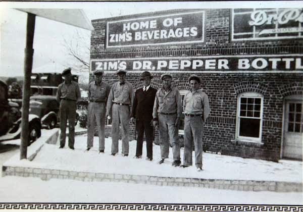
Zim's Bottling of Strawn
Showing posts with label Comanches. Show all posts
Friday, January 9, 2015
Friday, December 26, 2014
Wednesday, April 2, 2014
Pre-Settlement Comanches
The Tabernacle
When
folks say “Indian” in Eastland
County , they typically
mean “Comanche”. Alameda
became a territory of the Comanche Nation at 2:17 p.m. , November
11, 17 40 (I made the date and time up, but the year is
thought to be close).
The
recorded history of the Comanche epoch in Texas , written from an Anglo point of view,
is surprisingly robust. This account limits itself to events that occurred near
or directly impacted the Alameda
– Cheaney Box.
Modern coffee shop
opinion supports the Comanches’ right to live along the Leon River Valley (I agree). They acknowledge that
Anglo settlers invaded these Indians’ buffalo hunting grounds, destroying their
mode of survival (I agree). They believe that Spaniards and later Anglos
brought fatal diseases that wiped out Comanche Nation populations, much like
germ warfare (I agree, though this part was accidental). The Comanches’
forcible exile to desolate “throw away” land reservations on the Clear Fork of
the Brazos , then later to Oklahoma killed their chance to continue on
a proud path of triumph stretching back thousands of years. This is all
incontrovertible, based upon the evidence.
The comprehensive
truth of what happened around Alameda
from 1740 – 1874 confirms all of this. Taking both sides into consideration,
the full truth is more
complicated, however Settlers
eventually took the valley away from the Comanches “the people”, using the
strategies both (intentional and accidental) outlined above.
Ironically, the
Comanche’s spirit theology of The Land reflects more accurately what actually
happened. The People belonged to the land, not the land to the People. Anglo
settlers saw that world in reverse – this
land is mine..NOT yours.
The Comanche
exercised military/political control over the Leon River Valley during from around 1740 until
1874. They took control of this territory away from Wacos and/or Caddos (who
also probably invaded the land of whatever civilization predated them). Even Alameda ’s Clovis Man was
an immigrant, coming across the Bering Strait ,
walking from northwestern North America to
this place. No people were truly “from here”. No people were truly native. Only
The Land endures.
There were (and
are) thousands of well-meaning Comanches – men, women and children. Good people
– people you’d enjoy talking to, learning more about, being friends with. There
also were (and are) thousands of well-meaning folks of European ancestry. Most
of these people, you’d enjoy spending time with.
Both peoples
expanded into the Leon
River Valley
trying to make their lives better. They were only viewed as an invasion force
by whoever was there first. Displacement of whoever came before is a central
theme to both civilizations’ arrival on the shores of Mansker Lake ,
at the epicenter of this valley.
Both group’s
motivations are colored by racial and ethno-historical prejudices written into
each account. I found many stories specific to the Mansker Lake
area,
written from Anglo settler points
of view. Sadly, I found no Comanche accounts, specific to the same area, though
their stories from other locales exist.
There are
instances of Comanches and German settlers getting along near Fredricksberg to
the south, and sporadically in other settings. The western-moving American
Frontier and the-southern-moving, borderless nomadic culture of the Comanche
Nation, made eventual conflict inevitable. Unspeakable atrocities were
committed by both sides. Treaties were made and broken (usually by Texians and
Americans). Leaders from both sides could not always keep their brothers in
line.
Peace had a chance
while Old Owl and Sam Houston were alive. That flicker of opportunity came
briefly back to life when Robert Simpson Neighbors was Indian agent. Two of
these three men fell in the line of duty, one assassinated by enemy disease,
the other by a bullet in the back.
Old Owl is the key
to understanding the Comanche in Alameda
– Cheaney prior to the 1859 arrival of its first white settlers. Old Owl was the Penatuhkah’s civil peace chief, a co-chief
to the Comanches’ powerful War Chieftain Santa Anna. Old Owl’s camp was the
Comanche headquarters on the Leon
River until at least
1849.
Rip Ford describes Old Owl:
The Comanches arrived under their principal chief,
Mopochocupee – the Owl. Prince Owl was quite a respectable looking savage. He
had none of the swagger so ostentatiously displayed by bastard Rangers, and
self-styled frontier celebrities, who throw crowds into spasms of
astonishment and admiration by reciting the daring deeds
they never performed. His Highness was ready to accept anything in the shape of
a present from an old tooth-brush to a cloth coat.
When I visited the Comanche Nation in Lawton , I was told that the “real decision
maker” was often hidden behind the scenes, protected in case of treachery from
assassination or capture. The “chiefs” that were in contact with military
authorities, were sometimes only the mouthpiece of these “shadow” leaders. It’s
impossible to know if Old Owl was the true Comanche decision maker, but his
recorded actions and words indicate wisdom and a true leader’s heart for his
people. He was respected by Rip Ford, Sam Houston and Robert Simpson Neighbors.
Old Owl visited Washington D.C.
with Santa Anna and Neighbors in 1847 on horseback. The Owl was received by Sam
Houston in the marble halls of the Senate. He saw American government
buildings, thousands of American citizens in towns and cities along the way. He
saw American armies, cannons, the vast nation that was hungry to move west in
his direction. Old Owl recognized the future. He had to know that his practice
role as peace chief was the Comanche’s best hope for survival.
Old Owl’s
realization had to be hard on him. The Comanches had single-handedly forced the
mighty Spaniards from Texas .
They had ousted or enslaved every other Indian tribe they encountered. If the
Comanche was ever defeated in a war prior to the Texian/American era, this
defeat is not recorded.
From 1859 until
1872, the Comanche guerillas won most of the battles along the Leon River
Valley . Mansker Lake ’s
settlers retreated to Blair’s Fort for a time. Besieged settlers at Blair’s
Fort retreated to Fort
Shirley or Stephenville
as well. Wagon loads of anxious Anglo pioneers fled to the towns of
Stephenville, Weatherford and Fort
Worth fearing for their lives. Many went back east,
never to return.
The band of Comanches then operating
in Central Texas were the Penatuhkahs, the Honey-Eaters. There were instances
of peace between the Comanche Nation and white settlers. The Council House Battle of 1840 effectively ended Comanche
trust in Texians forever, however (their mistrust was reconfirmed repeatedly).
Thirteen
Comanche chiefs were killed when fighting broke out at the Council House peace
council in San Antonio .
Republic of Texas President Mirabeau Lamar ordered
the surviving Comanches arrested, hoping to use them as hostages until all
white captives held by the tribe were returned.
Most of the thirteen slain chiefs
were Penatuhkah. Buffalo Hump assumed Penatuhkah leadership, mounting several
retaliatory strikes, but his forces were defeated at Plum Creek. Santa Anna
rose to fill the role of Warrior Chief. The rise of Peace Chief Old Owl may
have been contemporaneous to this time period. The Penatuhkahs became bitter
enemies of Texians.
Arrowheads
thought to be Comanche are scattered all over the Leon River Valley . The only known concentration of
Comanche artifacts seems to be at the epoch-crossing Fulcrum Camp. This valley
camp is watched over by an east facing cliff. It is
timbered along its winding waters,
though a wide, grassy area for teepees, grazing and community was available. A
nearby peak could connect its smoke signals to Caddo Peak and the Santa Anna
Peaks to the southwest; to Ranger Station Peak to the north (then north to
Gunsight Mountain or east to South Gordon Peak); and also to Desdemona’s
Jameson Peak, then south to Comyn Peak and then Round Mountain in Brown County.
Smoke signals from
this Fulcrum Camp site would have gotten reception from all four directions of
the compass, and yet the campsite sits low topographically, protected from the
weather, and enemy surprise.
I
feel a certain kinship with some of the narrators of this story – I call them
storytellers. Some are alive, most are not – at least in the conventional
sense. And yet, along the trail, they were with me, speaking stories through
their actions, or in some cases only leaving clues. I can offer no other
explanation.
I
have from time to time felt led by Old Owl, his Indian name Mopochocupee. In
1849, RIP Ford documents his camp “on the headwaters of the Leon .” A much
later book by Kenneth Neighbours suggests that this ‘headwaters’ location might
have been where Armstrong Creek hits the Leon River .
I have reviewed Rip Ford’s original memoirs from that visit. There are no better
clues hidden in its pages. Hopefully someday, a comprehensive history of the
Comanche reign in the Alameda
– Cheaney Box will be written. As of this writing, the clues still hold their
breathy, waiting patiently in the woods.
The first Anglo
traveler through our parts that I can positively identify was Big Foot Wallace. He passed slightly to our east, then may have turned west,
coming up Bear Canyon east of Ranger. He writes on October 20, 18 37 :
We
took our course again, which was about due north and, crossing a range of
mountains at a place called “Walkers Pass”, we traveled over a rough broken
country to the South Leon Creek, a distance, I suppose of 15 or 16 miles, where
we “nooned.” We saw some fresh buffalo signs on the way and our old hunters began
to whet their bills for fat steaks, marrow-bones, and “humps,” but as yet we
have seen none of the animals.
We
found the grass very fine on the bottoms of this creek, and have concluded to
lay over until tomorrow, and give our horses a chance to recover, as they have
had but poor grazing for the last 48 hours.
We
had been in camp but a little while, when one of the boys found a “bee tree”
which we cut down, and took from it at least five gallons of honey. In the
evening I went out hunting, but saw no game to shoot at. On my way back to camp
I stopped to rest for a few minutes in a little canon that lay between two
rocky hills covered with thick chaparral. After a while, my attention was
attracted by a noise in the bushes and looking around I saw a large bear coming
directly towards me. I sat perfectly still, and he did not notice me, but came
slowly along, now and then stopping to turn over a stick or rock, in search, I
suppose, of insects.
When
within twenty feet of me I took sight of his fore-shoulders and fired, and he
fell dead in his tracks. This was my first bear. He was very fat and would have
weighed, I suppose, three hundred pounds. I went back to camp, which was not
more than half a mile off, and returning with two of the men to assist me, we butchered
him and packing the meat on a horse, we soon had some of it roasting before our
fires. What a feast we had that night on “bear-meat and Honey!” If the mess of
pottage that Esau sold his birthright for was as good as bear meat and honey,
and he had a good appetite, I believe the poor fellow was excusable.
In
the night we saw a long line of light to the westward of us, and supposed the
Indians had fired the prairie. The night was pleasant and warm.
following on our
trail, but he was a “scary” sort of fellow and we thought his story doubtful.
We
passed a singular chain of high bald hills today. Looking at them from a
distance we almost fancied we were approaching a considerable city, so much did
they resemble houses, steeples, etc. They were entirely destitute of timber.
The
Leon River where we struck it is a small
rapid stream [this was October], shut in on both sides by high rocky hills. We
crossed over to the northern side and “nooned” in a grove of pecans. These
trees are full of the finest nuts we had ever seen – very large and their hulls
so thin we could easily crack them with our fingers. Before we left, we
gathered a pallet-full of them and strapped it on one of our pack mules.
In
the evening we continued our route up Armstrong’s Creek, and struck camp a
little after sundown near one of its headsprings. The valley along the creek is
very beautiful and the soil rich. Our hunter today killed a fat buffalo cow on
the way, and we butchered her and packed the meat into the camp. That was the
first buffalo meat I ever tasted, and I thought it better even than bear meat.
The flesh of an old bull however, I have found out since is coarse, tough, and stringy,
but the hump is always good, and so are the “marrow-bones” and tongue.
Just
after we had camped, one of our men named Thompson, while staking out his horse
was bitten on the hand by a rattlesnake. It was a small one,
however, and he
suffered but little from the effects of the bite. We scarified the wound with a
penknife and applied some sod to it and next morning he was well enough to
travel. I do not think the bite of the rattlesnake is as often fatal as people
generally suppose...
Night
clear and cool – cool enough to make it very pleasant to sleep by our fires.
Toward midnight we had
an alarm that aroused all hands very suddenly. The sentry on post fired his gun
off accidentally, and we supposed, of course that the Indians were upon us. We
were all up and ready with our guns by the time the sentinel came in and told
us it was a false alarm. I was so completely roused up by the excitement and
bustle that I did not get to sleep for more than an hour afterward. The little
breeze that rustled among the leaves and dead grass the early part of the night
had died away, and a dead silence had settled over all. Not a sound could be
heard, except the howling of a solitary “cayote” far off among the hills, and
the nipping of our animals as they cropped the rank grass that grew around us.
The silence was oppressive, and when one of the men muttered in his sleep or
one of the animals coughed or snorted, it was an actual relief....
From an Alameda point of view, this memoir tells us
that in 1837 there were buffalo close by, and that there were no Indians then
encamped where Armstrong Creek hits the Leon River
to our south. In April 1844 and June 1845, Old Owl
was contacted along the Colorado
and San Saba Rivers. In 1848, Neighbors, John
McLennan, Jim Shaw, and Old Owl arrived at the Tenawish and Nocona Indian camp
on Lewis Creek , locally called Plants Creek,
which empties into the Brazos near the modern
town of Seymour .
“Neighbors found in the camp about two hundred and fifty Comanche lodges, fifty
Tonkawa lodges, and ten Wichita lodges. The great chief Pah-ah-yuca, head chief
of the Tenawish and Noconas, arrived in the evening, bringing with him the
hostile Tenawish, Nocona, and Kotsoteka chiefs, in order to put an end to the
hostilities.”
It is not known if
this Seymour
camp later moved to the Leon
River headwaters the next
year, or if this camp was a large, second camp existing at the same time as the
one recorded by Ford on the Leon .
In any case, in 1849 Robert Simpson Neighbors wanted to lay out a trail to the
upper Rio Grande
through El Paso .
Neighbors left San Antonio ,
and passed through Austin .
Dr. John S. Ford (“Rip” Ford) joined his expedition. They went to a Torrey
Trading House near Waco
and spent several days getting ready. Neighbors hired Penatuhkah
Buffalo Hump as his guide. They left the North Bosque Settlement, March 23, 18 49 :
Preliminaries
were arranged without trouble. The expedition set out before the middle of
March. It was a motley crowd. The Americans were Major Neighbors, Doc Sullivan,
A. D. Neal, and the writer [Rip Ford]. Captain Jim Shaw, a
Deleware, was
interpreter. The other Indians were: Joe Ellis and Tom Coshattee, Shawnees ; Patrick Goin, a
Choctow, and John Harry, a Delaware .
A band of Comanches traveled with us too.
One
morning Buffalo Hump awoke the camp with a medicine song. Ford said, “It
stirred up recollections of boyhood – the calling of higs – the plaintive notes
of a solitary bull frog – the bellowing of a small bull, and all that sort of
noises. Anon the awful melody of the sonorous gong was reproduced; the next
moment the mournful howl of the hungry wolf saluted the ear, which gradually
softened into something like the gobble of a turkey. It might have been a choice asortment [sic]
of Comanche airs gotten up to amuse and do honor to the Supervising Agent, but
it failed to solace his white companions.
The performance commenced about an hour before daylight and did little
to soothe the slumbers of the morning”.
Old Owl
led the expedition into his camp “on the headwaters of the Leon ” on the
fourth day:
About forty or fifty children who were in the
creek bathing ran for the wigwams crying “pav-o-ti-vo, pav-o-ti-vo”, white man,
white man, as loud as they could…We encamped near the Indians; numerous
delegations of children came to look at us and our trappings. The squaws also
evinced curiosity; many of them had never seen an American. We had time to
examine the wigwams and to learn something of every day life among the
Comanches…A deaf and dumb
woman attracted our attention. She was the only person we
saw laboring under these defects among several
thousands [author italics] of Indians. A very old woman was frequently in
our camp. The Comanches said she had seen more than a hundred summers. She
appeared to have things her own way: found fault, lectured, and scolded like
other old feminines. She had the appearance of a skeleton moving around with
skin on it…It was decided that Buffalo Hump should be our guide. He managed to
get most of his pay in advance. Mopochocupee separated from us. Buffalo Hump’s
band was traveling south of west and rather down the country old Owl stayed
behind.
I’m not
convinced that the “Upper Leon Headwaters near an intersecting creek” site that
Rip Ford speaks of is in fact where Armstrong Creek hits the Leon . I’ve been
to this site. The intersection looks little different than most of the Leon in
Eastland County, farther north there were archeological findings of a large
camp on the west side of the Armstrong Creek site found, but little on the east
side, as Ford reports.
A campsite
farther north, inside the Alameda
– Cheaney Box makes more sense. Based upon the cited “several thousands”
population of Old Owl’s Leon River camp, our topography better fits the
descriptions and repeated archeological findings at this location make the
Alameda – Cheaney site a much stronger suspect.
If the
expedition’s turn “south of west” back toward the Colorado River had been from
this alternate Alameda – Cheaney site, the expedition could’ve followed the
anecdotal Spanish Trail, said to lead away from within four
miles of this site (if this Spanish Trail truly existed, it was probably
originally an Indian trail).
Tragedy
engulfed this Comanche “township” after the Neighbors expedition departed the
Leon River Camp, from which the camp never probably recovered:
Shortly
after Major Neighbors left them in 1849 a scourge of cholera carried away three
hundred souls within a few weeks’ time. The faithful Old Owl and the
intelligent Santa Anna were numbered with the dead. These losses demoralized
the southern branch of the tribe, and henceforth disintegration worked
rapidly…As soon as they recovered from the cholera scourge, the Penatekas held
a general council and tried to select a head-chief to succeed Old Owl. One
account says a chief named Sanaco was chosen, but Buffalo Hump and Katumse,
another chief, visited Fredericksburg
to report that the honor had gone to Buffalo Hump. The title was an empty one,
from this time on the Penetekas themselves agreed that they had no common
leader. There was no one among them who could take the place of Santa Anna and
Old Owl.
I guess
now would be the time to relate the story of Comanche County ’s
Indian Mountain , just southwest of Gorman. This
site is about 15 miles from Alameda .
The story goes that one day in the 1920’s a farmer was plowing his field, below
Indian Mountain . Out of the corner of his eye,
he saw an Indian, in full feathered regalia, standing outside the fence. The
farmer walked over. The Comanche had come to pay his last respects to fallen
comrades (the last battle at this site was said to be in the 1870s). Later
visits by Comanche warriors to this site reoccured several times through the
years, it’s said.
Though
anecdotal, given the high honor and clear-eyed theology behind Comanche beliefs
about death, I have to believe Comanche oral tradition kept up with the
locations of many of their warriors’ final resting places. That geographic
information, if it truly exists, is still hidden far across a ripped apart
cultural divide, not yet fully healed. One hopes that in the future Old Owl’s
final resting place may be located, safeguarded and honored as an early leader
and patron of Alameda and Cheaney’s history, in addition to being one of the
Penatuhkah’s wisest leaders.
The Owl
uniquely understood what was happening to his world, and tried to ease his people
peacefully from one epoch to the next. One wonders what might have happened if
The Owl and Santa Anna had survived until 1859, when Alameda’s settlers began
to arrive.
The
exact location of Old Owl’s camp is unknown. It is clear that at most it was
a short ride away from the Alameda – Cheaney Box. Neighbors’ description
matches a
location inside this box. Even if
the site is at the Armstrong Creek location, supporting a
population of at least 3,000 Comanche citizens
would have made the rich Mansker
camped here, or merely hunted
here, this wise, unassuming sage walked this place. Old
Owl’s peaceful spirit sleeps
inside the Leon River Valley .
Friday, March 28, 2014
The Whisper of Old Owl
The Whisper of Old
Owl
Through
The Windshield
I
left Weatherford this morning, in search of Old Owl’s camp. It was last seen in
1849, best I can tell. If the stories are true, it lies just south of my
Alameda-centric box. A full moonlit night would carry a warrior’s steed to the
Mansker Lake Community in an hour.
I
turn south on Hwy 16 from I-20, the morning sun still coming in my east truck
window. I figure a trip across the foot of Cook Canyon
is a good way to time travel back into today’s nineteenth century search.
I’ve
tried to develop the skill of seeing
the land without its roads and fences. My John Wayne-colored glasses warn me
that Indians might lurk along the cedar-covered rim of the canyon to my right,
awaiting their chance to swoop down and surround me, fill me with piercing
arrows. This canyon still whispers its tragedies, from not so long ago.
I
pass across Palo Pinto Creek, the Indians’ highway through this country,
creating stories we’ve all heard, and a few never repeated, I’m sure. The
project’s
newest contributor, the one
translating darkly from outside our log cabin’s walls, says it’s important to
get a sense of a place. That the
Comanche were attuned to their world in a way that’s difficult for moderns to
understand. I sense as I cross this creek that I’m entering their world, hoping
for a sign I can follow into Old Owl Mopochocupee’s flourishing camp, one of
the largest Comanche camps in Texas .
What
do you ask of a Comanche who died over 150 years ago? Will he ride around with
me and point out all the old sites, my newest Shorty Fox? Will he have photos
of the significant people and places from his nomadic world? “This is me and my
friend Running Cloud the day before we attacked that wagon train up north –
good times.” Will he be able to tell me what he, and later Buffalo Hump felt
when these cursed settlers kept pouring over the hill from three directions,
killing all that the Comanche held dear?
To be clear, I
have little idea what I’m looking for. I feel pretty confident when I’m
tracking Anglo sites now, when looking for abandoned cemeteries, homesteads or
schools. Crooks in the road, cisterns in a field, fence lines that make no
sense – I can pursue these footprints with some assurance. With the Comanches,
I find myself again at the bottom of a new learning curve. Hopefully they will
share some guideposts I will need to track them, to make contact.
I
ascend up the southern rim of Cook
Canyon , up into the
gently rolling country between Salem
and Hogtown. This flatter plain would’ve been an easier path for our new
friends to follow, moving northwest toward Mansker Lake .
Before the log cabins
started showing up, the Comanches
could have continued, on toward their camp near Sweetwater. Later, they could
have stalked silently back to their reservation undetected, late at night. Our
new friend counsels, “look for paths of least resistance.” Our old roads often
follow theirs.
I
near Hogtown. Nearby Blair’s Fort is the last stop on the Stephenville – Fort Griffin Road
that I’m sure of. Some writings suggest it headed to Dallas Scott’s place on
the hill east of Mansker
Lake , before following
the Sanches Trail north to Merriman. Some suggests it continued north. Blair’s
Fort became Hogtown, became Desdemona.
Desdemona has
almost completed its metal volunteer fire house. The community still hold
dances and plays, though as of this writing the community has split into two
camps. Urbanization has not stolen this hamlet’s ability to fight for what it
believes in, even when neighbors become the enemy. There are still pickups
clustered around Desdemona’s combo gas station/café for coffee. This town still
has a heartbeat, maybe two.
The long-ago story
that I’m relying on this morning was written by R.I.P. Ford. “Rip” for all the
death notices he signed – Rest in Peace. Robert Simpson Neighbors talked Rip
into an expedition beginning at a trading post near Waco , heading for El Paso .
Buffalo Hump and the great peace chief Old Owl led the men to the wise
second elder’s camp “near the headwaters of the Leon ” after a four day ride. Ford’s
description is vague, at least the version I have. The camp was said to be
where a creek meets the Leon .
It was supposed to be one of the larger encampments in Comancheria, a
fully-functioning prehistoric society with many children and one lady said to
be over 100 years old. Rip tells us there were two to three thousand Indians
encamped here.
One much later
interpretation identifies a spot in northern Comanche County . I’ve highlighted that stretch of the Leon on my map
for today. Another 1936 journal (not necessarily related to Old Owl) tells of
finding eleven fireplace hearths, evidence of an Indian “work camp,” the man
says. Blow sand originally concealed the clay pits, three feet across and two
feet high. Rocks protruded from the top in a circle. This sounds similar to the
fire circles, or middens near Ranger. It’s unknown if this camp and Old Owl’s
are related. There are fairly specific directions to this 1936 location. I highlight it on the map as well. The two sites
are half a mile apart. Could they be the same?
The
country south of Desdemona is gently rolling, mostly coastal now. Was this land
cleared to farm cotton, or later peanuts? What did it look like back then, when
mounted warriors attacked Blair’s Fort, Mansker Lake ,
the Duffer Ranch? Looking down I’m still on striped, winding asphalt. I’m not
hot on their trail.
Uncle
Ben Freeman wrote that Jake Hamon’s locomotives couldn’t climb more than a two
percent grade. Though they sought to tie certain towns together, the railroad
searched hard in 1919 to find the easiest route. They too veered northwest,
avoiding Cook Canyon and eventually skirting eastern
Cheaney.
I’ve
looked at a lot of maps from as far back as the mid-1500s over the last couple
of weeks. Our stretch of the Leon
Valley , indeed most of
the Leon Region is omitted on all but a few. History appears to be happening
elsewhere. Today I am not so sure.
As I near the
little town of DeLeon
I wonder…Alameda ’s
Leon
river is straighter, is much easier to cross than the twisting Brazos . Before the tanks, lakes and wells, its water
volume flowed much greater. Many in the project remember the richly flowing
lion of a river before Lake
Leon was built, during
all but the driest years. And though we’re focused as moderns on the Comanches’
impact on us, it’s good to remember that they too had enemies before our
creaking wagons arrived…Apaches, Kiowas, for example. The rich Leon River
hideaway would have offered protection.
Archeological
evidence shows that Comanches and Kiowas lived up and down our stretch of
valley. The buffalo were less than a day’s ride to the west and northwest
(McGough Springs had a few…seven miles from Mansker Lake, as did Victor, ten
miles to the southeast). Other than the arrowheads and metates we’ve found on
the sandy ground, how could the Indian’s presence have been recorded before the
first Anglo families got here to see it?
I
pull into DeLeon about ten. The dusty little town will be my base of operations
today, a first. A green highway sign tells me to turn left if I want Dublin or Comanche. Why be greedy? One Comanche will do. I turn left.
DeLeon
is still in business. The Highway 6 Café parking lot is packed with pickups at
ten in the morning…I make a note for lunch time. The main drag boasts cars and
hard-working farm trucks parked along its streets – over half the storefronts
open, back in the mercantile game.
I head south out
of town, seeking the Leon
River just above Lake Proctor .
I’ll turn back north there and follow its waters to the base of Alameda Cemetery . Hopefully I will catch a
Comanche scent, some sign, some clue. One can’t help one’s paranoia.
I speed past a
wizened old man picking up pecans from the highway’s right of way, his old
truck with a busted left taillight dangling by two wires, next to the opened
tailgate pulled up near the barbed wire fence. A lady sits in a cream-colored
Buick just past the man, waiting at her gate for the mailman – a card from a
grandkid, a catalog, the Stephenville news paper.
I
slow within minutes, turn east onto a washboard caliche road, making a note to
thank Commissioner Christian for the smoother trails we enjoy one county
northwest of here. I come quickly up on the Ebenezer Cemetery
and stop. I’ll check graveyards along
today’s unfolding path, looking to see if they share Alameda and Cook’s signs of Indian
conflict. “Killed by Indians” a
tombstone clue that I might be close.
If you ever get a
chance to visit this cemetery, it’s worth a stop. Not quite as old as Alameda , it appears more
like our Cook Cemetery , showing episodes of great care
some years and busy descendants others. These headstones will pull at your
heart.
This lonely place
is made better by many concrete markers with the stark word “UNKNOWN” stamped
across each face. This sort of message used to make me sad, that some life had
been “lost” like that – forever. Whoever crafted these markers saw the larger
truth – each soul has been remembered
now, though their names and life
details still swim tantalizingly
out of reach. These slabs are breadcrumbs that will fall across the path of
someone, someday – the circle will be completed.
I’m
walking back to the truck and realize that I’m still thinking like a modern. I
look around for bent “Comanche Marker Trees” and spy none. Then far in the
distance, on the eastern rim of the Leon
River Valley ,
I see them – two linked peaks higher than anything in the area, connected like
the twin mountains above Coleman
County ’s Santa Anna,
Chief Santa Anna’s known headquarters (down which a runaway team injured Joe
Cheaney later in life). The peaks I see have a distinctive shape, would make a
good landmark. They’ve got to be five miles away at least. I crank up the truck
and head for the river bottom, watching my new goal as I drive.
I
stop to look at my old map, nearing the Leon , hoping the old bridge on this
map still exists. I start wondering how much my truck weighs.
The river bed
looks different here – more like a swamp with lonely willows and cottonwood,
ghostly with flood debris leaves and limbs clawing their trunks, like they
tried to escape this place and couldn’t.
I’m not comfortable here, want to leave. There is water standing beside
the road – menacing. I can’t imagine the Indians wanting to live here.
There’s
a dented old Dodge pickup pulled off the road…no one in sight. A fisherman,
hopefully, on an honorable enterprise. I cross the rickety bridge, bracing for
my descent through its rotting floorboards, make it, pushing up the other side,
rising quickly onto a giant plateau, old oaks with many-fingered crowns, like
heads of broccoli. Circling down again near the river, I come to a place that
has the feel of a campsite, near the mouth of Armstrong Creek. This concealed
hideout has a rise above the flood plain that suggests a lookout, but it’s too
low to see far away. It doesn’t fit Rip Ford’s description. I keep moving.
I end up at Comyn,
settled in the late 1870s after the Indian risk had passed, according to their
historical marker. Alameda
pre-1870 founding makes me proud – not going to let a few blood-thirsty
Comanches slow it down. Comyn was a railroad town, then home to a Humble
Pipeline tank farm. I pass through, my two peaks in sight, just southeast of
the almost evaporated settlement.
The
road rises, the peaks grow taller on my left. The ground falls away to my
right, to the east and south. I have a clear view miles and miles southwest to
the twin peaks of Round Mountain and the Long Mountain complex (1,800 feet
above sea level), almost in Brown County. While I’m two miles from the Leon River
now, I remember reading that the Comanches had lower subsidiary sites to relay
smoke signals from higher altitudes. These peaks behind me (the higher of the
two is 1,388 feet) were one of their “tall towers”. They could have seen
trouble coming from miles away. I savor a yes
moment. They were here. I feel the sense of place I’d been told about. Comanche Peak in Hood County
is about 1,224 feet by comparison, also having a distinctive shape.
A big ranch is at
the top of this peak. I am a hundred feet below and still have a great view. At
the base of the mountain two decaying homesteads meet me, one maybe both built
before 1900. A dense clump of mesquite and oak and a darkened draw off the
mountain betray a spring….look for water, for a view, for game, for the path of
least resistance. Story after story pour from Alameda about settlers invading the Indian’s
front yards with their cabins. We had to have made the Comanches scratch their
heads. “What are these light-skinned fools thinking?”
I
don’t think this is the Comanche’s main camp, though. It doesn’t fit Rip’s Old
Owl story, either. This could be its lookout. The smaller lookout earlier,
below Armstrong Creek, had an unobstructed view of this high place. I look to
the north and can see Eastland
County ’s Jameson Peak , to the east of the invisible
Howard Community (1,682 feet high, a distinctive shape, many arrowheads and
mano/metates found near a spring at its base).
I remember last week, seeing this same peak from the Comanche smoke camp
near Ranger. I have that “fill in the blank” feeling, feel like tumblers are
locking into place, three rich, red cherries in a row. I might be observing the
smoke signal promontory sites north, east and south of Alameda . Today, I see no smoke.
I
pass back through Comyn heading north. They now store peanuts in the giant
coffee can-looking oil tanks, sisters to the round ones that waved Magnolia’s,
then Mobil’s flying Pegasus back at me entering Desdemona when I was a kid
going to see Cora Lee and Elbert. Path,
of least resistance.
It’s impossible to
drive close to the Leon
River , because of private
property. I’m able to turn south and again get close to where Armstrong Creek
hits the sleeping larger river. Big Foot Wallace supposedly met the Leon here, then
explored north around 1837. I’m still south on the map from where Old Owl is
supposed to be waiting on me. How could Wallace have missed thousands of
Comanches? Did the band not arrive until after he passed, or is the site
further north than other historians have concluded?
I
get to the Leon
bottom’s flats. They look just like the land between Alameda Cemetery
and Mansker Lake …large pecans surrounded by
wheat-colored winter grass…easy to ride through on a horse, easy to pass
through on a wagon or a teepee pull-behind.
I
turn north, head up a road that would end up at Round Grove
Cemetery if I kept going,
but loop back to the west, following more Leon River Valley from a distance. The road is
narrow and I’m passing dairy trucks and eighteen wheelers leaving with freshly
cut sod, others with shiny-tanks full of milk and hard-working men in pickups.
“You lost, boy?” a question I don’t like to be asked. What am I going to tell
them? “Eh, yes sir. Could you direct me to Old Owl’s 1849 campsite?” I accelerate
on past.
It’s
funny how much one’s head moves to the left and the right when you’re driving
fifteen miles an hour looking for bent Indian trees or rises that could be
lookouts or teepees or marks on trees. I’ve got to get into Fort Worth more.
I cross over into
the stretch of meandering water I’ve highlighted on my map, based on the three
reports. Trees get dense on my left, between me and the Leon. I see a stand of
deer. I don’t see homesteads…I don’t see warriors riding horses through this
dense brush. But I can’t get close enough to our river…there could be a clear
path nearer the water.
I approach another
bridge and stop to take a photo, noting that the Leon ’s flow mirrors that below Alameda ’s cemetery. If
conditions here and there were also identical in 1849, it would be hard to name
the place where I stand “the headwaters”, at Alameda ’s expense farther north. I turn north
to loop around for another river crossing farther to the west. I see something
on a hillside, about a quarter mile away. Low to the ground, gray short
columns, built into a far hillside. My camera lens isn’t powerful enough to
tell me what it is. It doesn’t belong, though. I pull the camera down, and
finally see in front of me, bold and fully in focus, a sign-No Trespassing.
I
take off again, more than a little frustrated, now approaching the Leon from the
north, pass a high dollar place on a knoll above the river. I head down into
the peaceful, well-tended bottoms, littered with pecan trees as tall as
Eastland’s courthouse. It’s flat across this stretch, with tributaries needing
bridges twice. A shape catches my eye to the left and I slow. It’s a
grandfather pecan tree, a serpentine giant bent toward the ground, the main
trunk pointing east-southeast. Down
the river, toward the shapes on the hillside I couldn’t identify without
jumping a fence, without getting shot. My head whips to the left involuntarily,
then sweeps rapidly to the right – though I hear nothing. I’m ten feet away from a Native guidepost, a
Comanche Marker Tree. Could a Comanche
hunting party be far away? I pause, smiling at my delusion, at my connection.
I don’t know if
archeology supports this tree as a true People’s landmark. But the “pointing”
tree is facing in a way that the river’s current doesn’t flow - flood waters
would’ve pushed it another direction…it bends down, away from the sun, before
being sawed off. There’s no other explanation, given the old age of the stunted
tree. Could these branches have noted a river crossing…or does it point to the
hazy site I couldn’t see earlier, not a quarter mile downriver?
I take off, my
enthusiasm renewed. The far southern rim of this river bottom rises with the
road, has an Alameda
feel to it, more like the western cliff where the McGahas stayed. I drive up
the ridge and sure enough, there are several old homesteads…perhaps this river
bottom was their Mansker
Lake . The river below
this point still flows, but in truth looks like it does on the stretch behind
our cemetery, up through Cheaney, up under the Lake Leon Dam. I’m not convinced
that this is the country where Neighbors and Ford crossed west at Old Owl’s
camp.
I
head north out of DeLeon. It takes three tries to find the little road that
will return me to the river. One of those attempts is marked by a county road
sign, but takes me dead end to some people named Green’s front door. I swing
the wheel around quickly before the shooting can commence.
There
are two cemeteries on my map through here, not far apart. I again want to check
for evidence of inter-cultural conflict. I get to one crook in the road but
don’t find
headstones, as the map tells me I
will. Farther around I do find the Oliver
Springs Cemetery …not
started until 1885, according to the sign, too new to be of help (the Comanches
cleared out in 1874).
I loop back around
to the first site, crossing a spring-fed stream (car washes the only item I’m
under budget on). I study the map and reconfirm the first location…the cemetery
is gone. Bulldozed or plowed or whatever. There is no name for the cemetery on
my map. This pasture was made bigger, maybe for peanuts now coastal. I wouldn’t
think a cemetery out here would have been very large…half an acre more in
peanuts? I am saddened by this latest tragedy on the path.
After
Neighbors and Ford’s expedition left Old Owl’s camp in 1849, over three hundred
Native souls fell to cholera, within a few weeks, it’s said. Before the year
was up, even wise Old Owl and Santa Anna would be claimed, their final resting
place as hazy as these souls resting under the grass pasture, somewhere out
there, in front of my bug-addled front windshield.
I
turn north to catch up to the Leon .
I’m less than eight miles from Mansker
Lake by horseback, though
I’m still probably in Comanche
County . This road is
barely a road…I’ll be surprised if my grandchildren can follow this
soon-to-be-forgotten route someday. Up ahead a small herd of cattle wanders the
road-strays I think. Then I see a Ford pickup following behind in the ditch.
These cattle are being herded to another pasture. The climate-controlled F-150
saddle mount seems to work great, until the cattle need to make a left turn off
the almost-gone road, through a gate into a pasture. A
modern cowboy opens the door to his
modern Henry Ford horse, gets out waving his arms and a white rag tied to the
end of a lunge whip, convincing the herd of his wisdom. Buddy Rogers tells me he finds Dodge trucks
superior for herding and cutting cattle.
I
come to the point that I can’t follow the Leon any farther north. I’m miles
from where I can rejoin it, just below Mansker Lake .
More fence, more private property – I channel the Comanche’s anger.
I cross over
Highway 16 again, and head through the country toward Victor. Though not part
of my plan today, Comanches were reported in this area as well and the sun is
still too high to start serious photography. I’m driving slow…I find myself
thinking “where would the Comanches have liked” and occasionally, as I near
streams or hollows or quiet bends in the road, hear the thought “they would
have liked it here.”
I keep coming back
to the smoke signals. To life’s raw ingredients that these guys would’ve looked
for before making camp. I put my map away.
I
bend into another county road. I suspect that I’m in Erath County .
No fences or bar ditches along the ten foot wide trail, crossing cattle guards
as I enter and leave each fenced around place. This terrain has rolling hills
that have lookout potential, but nothing as high as what I saw earlier.
I
come up on a farm place…this little road makes me feel like I’m intruding, like
I’m driving through their front yard. There’s a mailbox. There are old pickups
and tractors and junk scattered wildly around the place. Some diesel tanks have
leaked and poisoned a giant hulk of a live oak, standing dead on its feet. The
present owner is
living in a large storage building
like you’d buy beside the freeway in Fort
Worth , to store your lawnmower. Across the yard sits a
once bright yellow house, a Sears and Roebuck Craftsman, I’d guess. Its window
glass is gone. Black rings above the window frames betray a fire long ago.
Another sprawling live oak pokes at the roof – wanting to go inside.
I’m
not sure which would be sadder to the folks that built this place, coming back
to see what I see, or to see bare ground, all evidence of their lives erased.
I
turn back up the trail. It’s getting late. I catch myself wondering if there
will be a full moon tonight, if their braves will ride through these hills
looking for trouble. The sense of place and the sense of time finally becomes a
conversation.
I
stop at the Bethel
Cemetery , with a quaint
wooden plank one room building that could have been a school or church. I take
pictures, the light finally beginning to cooperate. I gently push open the door
and get a pleasant surprise. There are pews. The wood planked floors are in
great shape. An old piano leans against the far wall. All we need is the lost
Bethel Community to show up, and we could have church. Could share one final
prayer before darkness comes.
I’m
tired and I want to be home. I turn north, grab hold of some interstate
pavement, and return to the world of speed limits and cell phones. I hope the
next time I come out here, there is a feathered someone to greet me.
I’m thinking about
smoke signals. I wonder who the switchboard operator was in Cheaney. I’m sure it was a party line, but I don’t
remember anyone talking about it. I’m not making a lot of sense.
I’m
thinking that a sense of place goes on forever. Mr. Cheaney’s father Leander
was a scout to Kit Carson, who faced Comanches many times. Is it a coincidence
that his son would move from his dad’s place near Rustler, settle near
Cheaney’s Comanche-muddied banks of the Leon, then move first to near Chief
Spirit Talker’s camp at Mukewater, then to the mountain base of the mightiest
warrior chief in Texas at Santa Anna? Did Leander get infected with the
People’s sense of place, then pass it genetically along to his son?
It’s
easy to feel frustrated. I don’t have photos of me and Old Owl drinking coffee
this afternoon, sitting around swapping stories. Of Buffalo Hump in his
feathered warrior array wanting to go liberate some horses from wily Old Henry
Mansker. I used to feel this same frustration about the Cheaney Community when
all this started. I persuade myself that I have collected golden nuggets today
as Kenworths roll past my window, puzzle pieces that will form a fuller picture
someday, after I’ve put in more miles. Cheaney’s fragments finally started
coming together that way.
I’ve walked right
past more historic places on this journey than I’ll ever admit, the treasures
remaining hidden until they chose to present themselves. Sometimes you try too
hard to put lost tidbits back together. Today I’m not so sure. Did my ‘it could
have happened here’ really amplify a quiet chieftain’s whisper – “it did happen
here.”
Did that lonely
stretch of road, that narrow winter’s thread of water share its rippling memory
with me today?
I’m supposed to
meet Linda Pelon at a confirmed Comanche camp in Dallas County
in a couple of weeks. “It has all of the signs,” she tells me. Everything the
People looked for in choosing a home, if you know what to look for. Those
puzzle pieces have already been put back together, will form a good example.
I’ll have the lay of this country firmly planted in my mind then. And its
whispers to lead me.
Friday, January 24, 2014
Frank Sanchez and Calvin Vernor
Frank Sanches Comes Home
Then Leaves Again
When I finally reached
the Nueces River Valley ,
the man I was seeking was already dead. This valley is deeper than the Leon , up north.
But the mysterious waters of the Nueces ,
carving shallow bends and then deep water holes strikes me as sister to the
sometimes ferocious lion river snaking beneath Alameda Cemetery ’s
shadows.
Frank’s trail had gone cold, many months
before, far to the north in that Eastland
County echo. Blind luck
even called me to this place…connected me with another mythic Alameda-like
community.
Frank left behind a wife and five children.
My found friend’s humble earthen grave has
been desecrated, on purpose – malice and aforethought. Like the Wicked Witch of
the West, a sturdy house has landed atop my hero’s final resting place. He’s
underneath that structure’s weight. Frank’s painstakingly-carved brown rock tombstone’s
been stolen, used to prop open a door like some trash rock from the field, then
taken into Travis
County exile as some
stranger’s trite souvenir.
This Cheaney Community pioneer’s grave is unmarked.
If you don’t count the house.
Another man along my trail south told me,
not even a week ago: “There are only two types of people in this world, those
who build and those who destroy. It has always been like that. It will always
BE like that.”
That man was right.
I talk to my deceased friend today, to the
man buried beneath the house. Frank was and is the thick bottom trunk to a
sprawling family tree stretching across America . “People that care are working
on your behalf, Frank. Folks-up-in-Years can extract justice from the Destroyers.”
Graves never answer, in my experience.
I keep talking. “I need to know what
happened here.”
Stories from within those graves can speak,
however, if you listen long enough.
Frank Sanches somehow makes my seventy-two
cent black writing pen begin to talk. What you’ll read below is a true story,
told by a circle of people who have mostly never met. All Texans of good will,
and all the folks with ties to the Leon
River Valley
connect to this Frank’s story.
If you stand under the late-1800’s wooden
Tabernacle at Alameda Cemetery long enough, I believe that any man or woman who’s
ever walked or galloped past, living or dead, will again ride up and start
talking. Start telling stories. Crazy talk, I know.
But it keeps happening.
I’m sitting at my desk
working, checking emails. I receive a note from a lady who claims to be a
long-lost descendent of Frank Sanches. He’s the man that folks in Eastland County hold out as the first permanent
Anglo settler. Believe it or not, Frank Sanches/Sanchez was a fairly common
name back in the mid-1800s. So this lady and I go back and forth with
identifying questions.
I come to know it is our Frank Sanches.
The one whose two lost
log cabins sat alone and unguarded on the east side of Jim Neal Creek in northern Cheaney.
Only a few hearthstone
rocks remain today.
Frank’s tangled story
scattered like dust, thrown into a cold autumn wind, as the Tabernacle book
left my hand. I knew he’d been there. I knew he’d left. I could walk to where
the man’s log cabin once stood. Like so many calling to me from that distant
fog, I surmised why he’d taken his family and abandoned ship (angry Comanches,
lots and lots of angry Comanches sweeping down their inherited raiding trail
along the Old Alameda Road. Not far outside Frank’s oaken front door).
As the book went to press, what happened
next was a mystery.
This is what I wrote
about Frank in The Tabernacle:
“Frank Sanches and
Jim Neal are the first Anglo men known to have settled in Eastland County .
Several explorers passed through first, but Frank and his step-son-in-law Jim
Neal were the first that constructed cabins, settled in to earn a living and
tried to make a go of it. They arrived in 1856. Their two log cabins and at
least one large corral, were about a mile and a half up Jim Neal Creek from the Leon River .
The Sanches and
Neal log cabins stood empty when the census taker rode by in 1860. After the
Indians left that country in the 1870s, the Cheaney Community would spring to
life just southeast of Frank Sanches’ first brave toehold.
Francisco
(“Frank”) Sanches was a Creole from New Orleans , born between 1802-1808 in Louisiana , probably of Canary
Islander/Spanish descent (he probably had coal black hair, a good thing in the Leon River
Valley ). His wife was
named Jerusha Tidwell. He landed in Texas
in 1835, the year before the Alamo fell,
(entrance certificate No. 472), and lived in Nacogdoches County
for a few years. Frank began to follow the ever-moving frontier west shortly
thereafter.
By the late
1840’s, Frank Sanches was living in Navarro County .
About 1849, Walker
County ’s John
Stubblefield {related to the later Coffer/Stubblefields
of the Leon River Valley ?}
employed Sanches to run cattle on the open range
off Pecan Creek, near present Bynum in Hill County .
Frank then moved to Parker
County , pre-empting 160
acres on a creek above the Brazos , now known
as Sanchez Creek. From this base, he ran cattle in
Parker, Palo Pinto and Erath
Counties , as was the
practice back then.
As the frontier pushed westward, Sanches saw an opportunity to relocate his cattle operation
farther west into less crowded territory. He chose a site in the Leon River
Valley , in present day Eastland County . His homeplace along the Jim Neal
Creek was many miles from
the next family of settlers, far to the east.
Sanches scouted a cattle trail that
came to be known as the Sanches Cattle Trail across Erath County ,
passing Davidson Springs at the Davidson Ranch near Tanner, then Rattlesnake Mountain , in present Eastland County .
The Sanches Cattle Trail ran south to below Jameson Peak , northwest to Mansker Lake , north to Merriman, then west to McGough Springs. In Eastland County ,
it passed the old settlement of Central (northwest of modern-day Cisco), then
headed to the end of the trail in Abilene ,
Texas . At this point, it
connected to the much higher traffic Western Trail going north.
The Stephenville - Fort Griffin Road largely followed this
trail much later. The Sanches Trail was later used by immigrants and government
freighting contractors who supplied the troops at Fort Griffin
and other West Texas military posts. This
trail is
believed to follow one of the
original Indian Trails (based upon archeological findings along its path), and
eventually became the Old Alameda
Road .
The Sanches cattle grazed far up and down the Colony Creek
Valley , the Leon River
Valley and out into the
grasslands extending far beyond both. It is hard to imagine that Sanches didn’t
have Indian trouble, being so isolated within their historic hunting grounds,
and near one of their major transits. A brother of Frank is said to have spoken
an Indian dialect, but if Frank shared that skill, that life-saving detail is
lost to history.
By 1860, Frank Sanches and James Neal uprooted again to McLennan County .
Not long after that, the family moved to Edwards County ,
settling near a spring (now known as Sanches Spring)
near the Nueces River , in the area of modern Barksdale.
In 1867, a man named Hill who was traveling in that country found Frank Sanches dead, an arrow still lodged through his lifeless
body.
Frank
Sanches’ story while he lived in Eastland
County is largely
conjecture. Based upon circumstantial evidence, Sanches grazed his cattle in
the wild over thousands of acres, much as Fuller Milsap did to the east in Palo Pinto
County . The only recorded
corroborating story of Sanches’ Eastland
County exploits, by Kenny
in “A Comprehensive History of Texas”, reports that in 1858 the Comanches came
across a man named Peter Johnson and his eight-year-old son Ike, driving a
wagon loaded with flour and meal in Bosque
County .
The Indians
killed the father and took the little boy captive. They left the settlements
with a lot of stolen horses and cattle. When the Indians were fifty miles
away, they took the boy’s clothes
and turned him loose in the wilderness, thinking he’d die of exposure/frostbite
or be eaten by wolves. The account says that little Ike found some cows,
staying with them for heat and sustenance until he was discovered.
Mrs.
Langston, in her History of Eastland
County tells us:
Frank
Sanches was out hunting stock and stood and watched numerous droves passing
down to the Leon River for water, hoping to find some of
his stray two-year-olds. Imagine his surprise as the last yearling was nearing
him, and he was about to turn and retrace his steps homeward, to see a small
boy’s head bobbing up just behind the calf. On the child’s approach, he found that
it was a white boy who had been captured by the Indians. He had escaped and was
following the stock, hoping to reach the settlements. Mr. Sanches cared for the
little boy and returned him to his people.”
Other
sources list parties other than Sanches as responsible for finding and
repatriating Ike Johnson.
Sanches
and Neal left Eastland
County no more than three
years after their arrival. Given their homestead’s location near an ancient
Indian highway, their isolation, and their large inventory of cattle, one has
to believe that something bad happened out there in those woods, once, maybe
several times, that made them want to leave. Whether or not lives were lost,
whether children died of disease or worse, remains a mystery. Perhaps a silent
dread that such tragedy was imminent drove them away.
Whether
Sanches was still living along Jim Neal Creek in 1859 to meet Henry Mansker
(settling to his south at Mansker Lake) or John Flanagan (to his north near
present day Merriman in 1858), we will never know. If he did, his advice would
have been interesting to hear. Frank Sanches and Jim Neal voted with their
feet, and left this country, never to return.”
This is what Frank Sanches wanted us to know, after that
book’s journey was finally closed. Frank was long gone when Uncle Henry Mansker
and Mr. John Flanagan made it to our Leon
River Valley .
It’s unclear to me how so much of his Eastland County story survives, as only
two empty log cabins and a broken down corral testified to his having ever been
there.
The nice woman from the email puts me in touch with her
daddy, Calvin Vernor of Camp Wood ,
Texas . Camp Wood is almost 250
miles to the south, near Leakey, not too far from Uvalde. Vernor is the great
grandson of Frank. Calvin is thankfully also a historian. Living so far away,
we’ve had to shake hands, and drink coffee over cell phones and thick envelopes
through the mail.
Calvin
Vernor is 79-years-old, and works hard every day. In addition
to his normal projects, he’s on the “restore the old Spanish mission committee”.
He knows the history of the Nueces
River Canyon .
Kind of a local historian storyteller. He’s a nice man. I enjoyed our visit.
Frank was the
first Anglo settler living in the Upper Nueces
country. The man had a knack for being first to a place, seems like. He arrived
before the army got there to protect local settlers. He ended up living there
about ten years before being murdered in cold blood. Their first homestead was
above the Sanches Springs, in what is now Barksdale. Again, pulling out a map,
you’ll be struck by the echo of his place, just above a major river/creek
intersection, like say Jim Neal Creek two miles before hitting the Leon River.
The army got there
in 1857 (this is a well-documented date), so Frank probably arrived in the Nueces country about 1856. The army reports his being
there when they rode up. There were several beautiful springs there then, that
he carved his initials into. There was a cave at Wallace Mountain ,
a cave near the top, where Frank created a beautiful carving into the hard
stone containing his name, and a large, ornate Masonic emblem.
Another man
explored out that way around 1921 and chiseled Frank’s work out of the wall to
bring back to town. When he got the old carving free of the wall, it was too
heavy to carry. He went back a couple of weeks later, he said, and Frank’s
artistic mark on the earth was gone.
I think about all
the carvings into the moss-covered stone up on Button Top, a prominent rock
mountain pug nose above the Leon ,
where stray Alameda
kids skipped school. The place is littered with old initials, carved into the
stone. I remember something else and smile. One of Frank’s sons, living not a
mile to the north of Button Top was nicknamed “Button”.
There are no
photographs or drawings remaining of Frank or his wife Jerusha that Calvin
knows of. Frank was a good man, a hard working man, Calvin tells me. He used
his Bible often. There were no churches down there, back then.
If you look at
photographs of the Nueces
River Valley
where Frank moved to after Cheaney, you’re quickly hit by its resemblance to
the Leon River , over against the tall cliffs and
hills rising from its seasonal waters, just to the west of Mansker Lake .
You
also find out in a hurry that their valley was also a favorite stomping ground
for Native Americans of many Nations – Lipan Apaches, Comanches, et al. Flint
points, shell beads, pottery and many other artifacts testify that Native
peoples used the Water-Game-Protected Valley trifecta of the Nueces Valley as
their Eden, just as our Leon River Valley Natives did around Mansker Lake and
tributaries leading past it.
Franciscan friars
built an unsuccessful Spanish Mission, San Lorenzo
de la Santa Cruz
in 1762 at Camp Wood . It was abandoned. Later in 1857,
the U.S. Army carved an army post near the old mission’s fallen ruins, using
the friar’s original spring for drinking water. Today the small town of Camp
Wood in Real County boasts about 800 folks, a five store strip mall, a drug
store with a soda foundation (“serving great floats”, their website says) and a
movie theater (with three movies a week).
The Camp Wood
army post was tasked to protect the vital San
Antonio – El
Paso Road from Indian attacks. Camp Wood
was abandoned by the army for a time in 1857, then brought back to life until
1860 by John Bell Hood, of Hood’s Texas Brigade fame. Union troops later fled
the place en masse trying to make a
break back to the North in the spring of 1861. Confederate forces moved into
their abandoned digs and set up shop.
After the War of
Northern Aggression (Civil War) concluded, army soldiers and Texas Rangers
periodically used the camp, it was said.
Bill
Badger, writing for the American
Military University
about Camp Wood (“Camp Wood , Texas
– A Military History, 1857 – 1861”) tells us that Frank and Jerusha moved up
the Nueces River Canyon
to be closer to the army.
The army reports
that the Frank Sanches Family were the first permanent settlers in the Upper Nueces
Canyon …being there when
the army arrived. Frank raised maybe 200-300 head of cattle. Their original
place was three miles upstream from the army camp.
Calvin knows of no
visible remains of their first homestead.
Frank built his
family a cedar picket house (straight cedars, sharp arrow-like points in the
air, driven vertically into the ground). I wonder if his Cheaney home was a
picket house too, much like the oak picket Blair’s Fort, built a few years
later to his southeast in Desdemona. Calvin tells me that Sanches Springs in Barksdale , Texas
still runs, but not full-out like it used to. There’s a swale under the
farm-to-market road, running east to west from Hamilton Hollar toward Frank’s
homestead that always made me believe a non-vanished spring fed its erosion,
before the time of wells, runaway mesquite trees and stock tanks.
Frank originally moved
to Nacogdoches
from a village outside New Orleans .
His parents got off ship at New
Orleans after arriving from the Canary
Islands about 1790. Frank was born in a settlement near New Orleans about 1814.
On July 22, 18 35 , he
entered the Republic
of Texas with his friend
Andrew Rojas. His entry certificate says he was a citizen, a man of very good
moral habits, industrious, a lover of the constitution and the laws of that
country (Texas ),
a Christian, and unmarried without a family.
Frank married Jerusha
Tidwell on Feb 13, 18 44
(a widow with two children). Jerusha is a Hebrew name, meaning “wife”. Their
marriage license was also issued by the Republic of Texas
(I have copy) in Nacogdoches .
The 1850 census
shows Frank and his wife Jerusha having two children together, and that they lived
next to Frank’s friend Andrew Rojas in Navarro County .
Son Joel Mack (nicknamed “Button”) was born in 1851. Also in 1851, Frank had a
cattle ranch on Pecan Creek in Hill
County , north of the
present town of Bynum .
A daughter they named Winnie was born there. Winnie later married W. R. Webb.
That’s how Calvin ties to Frank and Jerusha.
Frank then ran
cattle on the open range farther north and was taxed for a 160 acre place in
Parker County (southwest of Weatherford) on a creek named Sanchez (spelled with
a “z”). I pass a green TxDot sign taunting “Sanchez Creek Estates” every time I
go west down Weatherford’s Ranger
Highway toward Alameda , Cheaney and beauty.
Calvin tells me
that Frank’s bride Jerusha (pronounced Ja-roo-sa) was a doctor for the army. A
soldier’s diary from the camp backs him up. Calvin doesn’t know how she got her
medical training, but she was definitely considered a healing frontier doctor
for that country. Perhaps her Cherokee mother or her French father taught her
the medical skills she possessed. She is known to have used native plants in
her practice, giving credence to Native training by her Cherokee Nation mom.
The Army hired her officially as their doctor at the camp. Calvin told me that
she removed lots of arrowheads from local settlers during their time down there.
I copied this from
the “1491 Days in the Confederate Army”, by W.W. Heartsill:
”June 10th (1861): At 4 o’clk this morning F. M. Marshall was violently attacked with an Apoletic (sic) Fit, and in thirty minutes in spite of medical aid he expired. This last unexpected death of one of our number, in addition to the one we heard of yesterday and the victim to day is (unreadable)…messengers of the other’s death, has cast a gloom over our Camp such as was never witnessed before; so soon, in less than two months, two of our number are ushered into Eternity. At 6 o’clkMarshall is buried with Military honors,
beneath the wide spread boughs of a large live oak, not far distant from Camp.”
”June 10th (1861): At 4 o’clk this morning F. M. Marshall was violently attacked with an Apoletic (sic) Fit, and in thirty minutes in spite of medical aid he expired. This last unexpected death of one of our number, in addition to the one we heard of yesterday and the victim to day is (unreadable)…messengers of the other’s death, has cast a gloom over our Camp such as was never witnessed before; so soon, in less than two months, two of our number are ushered into Eternity. At 6 o’clk
Remember that oak
tree.
Calvin tells me, “When
the North and South got to fighting, the army left and suggested that the
Sanches’s leave too. But they didn’t. The Army left in 1861. Calvin is said to
have told his departing Army neighbors, ‘I’m staying, y’all come back soon’.
Calvin shares that
Frank and Jerusha got along great with the Lipan Apaches coming up the canyons
from Mexico ,
though the Indians stole horses and cattle from other area settlers. Perhaps
Jerusha provided medical help to the Lipan, he wonders. Perhaps the family’s
black hair kept them safe, I wonder, remembering blond-haired savagery closer
to home. The Lipan Apaches and the Comanche Nation were then sworn Plains
enemies.
The Comanches
frequently attacked Frank while he was out working his stock. He always managed
to get away into the trees where arrows are less effective, and escape to home
and safety. Frank lived six more years after the Army left before the law of
averages caught up with him.
Calvin speaks to
me through a static-filled cell phone, more quietly this time, that when Frank
didn’t come in from working cattle that night, Mrs. Sanches got some men and
went looking for him. They found him fallen over dead with several arrows in
him, just above where the town of Vance is now, twelve miles above Camp Wood.
That was September 1867.
“At the time Frank
was killed by the Indians, there was hardly anybody here at all except him, his
wife and five kids and maybe a few other settlers,” Vernor said.
I think about the
long now-secret trails Frank and Jerusha traveled during their love together,
sad that their longing to live together until old age reward never came to
pass.
They took Frank’s
body home, traveling in fear of another sweeping Comanche attack, I’m sure.
They rode down the lonely Upper
Nueces Valley ,
passing beneath the shadows of Bullhead
Mountain , Hog Pen Mountain , Turkey Peak and Meridian Mountain
to their home.
Frank was buried
under that same sprawling oak tree in the Camp Wood Army Post Cemetery with a good stone marker Frank
had carved himself, with a beautiful chiseled border. He was real good with a
hammer. Mrs. Sanchez had his name cut into the stone after he died. Frank was a
32nd level Mason, another echo back to the Mansker Lake Community.
The Masonic emblem is said to be visible yet on Frank’s tombstone-in-exile, in
some house in Austin , Texas .
There came a time
much later when the area around the town of Camp Wood started developing: about half the
new folks were good people, about half were said to be outlaws.
Another echo.
Some guy wanted to
build his new house in 1927 on the Camp Wood Army Post Cemetery spot where
Frank and Army soldiers and I’m sure other pioneers are buried, so he did. That
construction desecrated between 12 and 25 graves, it is thought. The house is still
standing, lived in I am told by a Church
of Christ minister.
Unlike the heroes
and heroines of Alameda ,
Cook, Gregg and so many other Leon
River Valley
cemeteries, Frank was not able to rest in peace. The headstone that marked
Frank’s grave in the Camp
Wood Army
Post Cemetery
for over 140 years vanished.
Frank left blank a
space for the specifics of his demise, to be inserted later. I have a photo of
the stone. It would take your breath away, as it is a moss-covered brother to
the brown rocks that litter Alameda ’s
lonely hillside. It shows that Masonic emblem, carved by Frank’s industrious
hand.
Frank’s
tombstone was used as a back door stop from 1927 to when the property was sold
in 1945, when it was moved to the front of the house until 2005, then ended up
in Austin as a souvenir.
The F. M. Marshall
I told you about was the first burial at that cemetery. The cemetery has been
there since 1861 (a twin to Alameda ,
as there could be unmarked Alameda
graves dating back as early as 1859, based upon our settlement timeline, or
Natives likely before that.)
The Camp Wood
Army Post
Cemetery graves were interred
farther apart than cemeteries of modern times, he told me. A Captain Cunningham
was one of those buried there. “I know the location of the Captain’s grave as
was told to myself when I was young and an old timer was old,” Calvin told a
reported once.
The house sitting
astride those fallen Texans was recently remodeled and added on to. This is
some long-ago heresy against our past.
In October 1867,
Frank’s widowed wife Jerusha filed to have his estate administered (I have a
copy). The Letters of Administration list 16 cattle brands as his (like the multiple
cattle brands of Schmick and Mansker stock at Alameda ).
Frank was
Jerusha’s third husband. Jerusha means wife. All three of her men had been
killed by Indians.
I ask Calvin about
Jim Neal, Frank’s step-son-in-law for whom one of our creeks is named. He
recognized the Neal surname. Thought Jim Neal was a prior son to Jerusha,
before she married Frank. The Neals grew up in that Upper Nueces
Canyon , also, he told me.
Jim Neal’s son was murdered, but I didn’t get the details. The Neals have
descendants in Arizona
today.
Frank left behind
a loving wife and family – three boys and two girls who were industrious like
their parents. Jerusha was still a medical doctor who walked for miles to
deliver a baby or treat the sick. She passed away in 1884 from “cancer of the
face”, at 75 years of age, buried with a marked tombstone in the Vance Cemetery
as its earliest resident. Her cancer is thought to have been brought on by all
those years in the sun, walking to cure her neighbors’ ills.
The State of Texas has erected a historical
marker to her at Barksdale.
The three Sanches sons
continued to ranch and did some irrigated farming (Frank never farmed). After a
time, the only remaining child in the canyon was the youngest daughter, Winnie,
who married W.R. Webb.
There are thought
to be more than 1,000 descendents of Frank Sanches walking in this world. The majority
are in West Texas and Arizona . “The children changed their name
from Sanches to Little before 1900,” Vernor said. “Other descendents are Webb,
Hicks, Handley, Vernor and some others.” Little means the same as Sanches in
Spanish, I was told, but it also seems to come from the Latin “santus”…holy.
I wish you could
see Mr. Vernor’s notes to me, scrawled on photocopies from newspapers and
books, on index cards, on stray pieces of paper – not pretty, but the message
was passed and received…a treasure chest about a great man named Frank Sanches,
who in my mind, is today at last closer to home.
His hand-carved tombstone
still needs to come home, however.
And the house atop
his hallowed remains needs to be carefully removed.
This afternoon it
will soar to near 100 degrees, at the lonely Alameda Cemetery Tabernacle. This
part of one man’s tale is over, for now. Frank Sanches rides away…
------------------------------------------------------------
This story was roughed out to get the facts
down, not for publication (at least until Frank’s final resting place plot line
has been completed, and until proper citation can be undertaken). Based upon
the Army records, it will now be possible to more accurately reconcile the
dates of Frank’s life, which are currently all over the map. Many thanks to
Trisha Mayes; Mr. Calvin Vernor; the Uvalde Leader News; “The Images”, a book
by Wanda Handley; the Real County historical website; www.campwood.com/history.htm;
the County of Nacgodoches, Texas; Bill Badger, writing for the American
Military University about Camp Wood (“Camp Wood, Texas – A Military History,
1857 – 1861”); “1491 Days in the Confederate Army,” by W.W. Heartsill; Allen Stovall,
“Headwaters of Neuces River”, a book; and the City of Camp Wood.
Subscribe to:
Posts (Atom)